Approximate Location Map
Large Map »
Latitude: 56.0612 / 56°3'40"N
Longitude: -2.7187 / 2°43'7"W
OS Eastings: 355343
OS Northings: 685610
OS Grid: NT553856
Mapcode National: GBR 2V.Q152
Mapcode Global: WH7TD.6XM8
Plus Code: 9C8V376J+FG
Entry Name: Harbour, North Berwick
Listing Name: Harbour
Listing Date: 5 February 1971
Category: B
Source: Historic Scotland
Source ID: 384157
Historic Scotland Designation Reference: LB38730
Building Class: Cultural
Also known as: North Berwick, Harbour
ID on this website: 200384157
Location: North Berwick
County: East Lothian
Town: North Berwick
Electoral Ward: North Berwick Coastal
Tagged with: Harbour
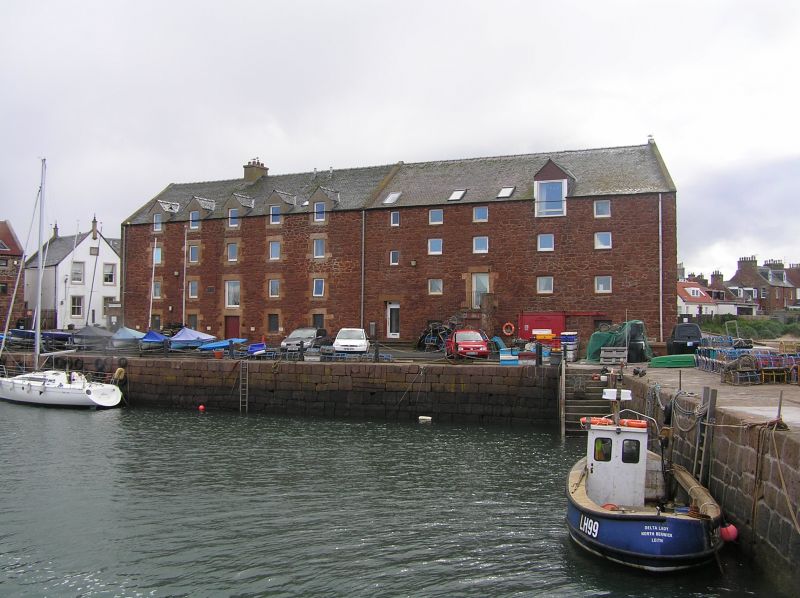
Late 17th to early 18th century harbour, projecting to N between North Berwick and Milsey Bays, with later repairs and additions. Circa 285ft long by 105ft wide. Large rough Law stone blocks with some earlier boulder work remaining. Stone steps cut into N, S and E inner angles.
NW BREAKWATER: set on Platcock Ridge. Some uneven dry-stone masonry with securing wooden wedges to outer face at N. Substantial parapet of pointed blocks shielding quay on basin side. Polygonal enclosure to parapet at W, 1811, with some pulvinated blocks and string course, large Law stone pawls to quay.
NW PIER: early 18th century.
SW PIER: circa 1802.
SE QUAY: possibly circa 1788.
Dunbar Old Harbour bears similar wooden wedge securing pins. The harbour is still dry at low water, as reported by Groome. Various excavations in 19th century. Former boom pier to SW pier. Warehouses to SE listed separately. Export of potatoes and import of guano and coal flourished from harbour in 19th century. A 19th century swimming pool which was sited to the NEcorner of the harbour was filed in the mid 1990's to form a dinghy park level with adjacent land.
External links are from the relevant listing authority and, where applicable, Wikidata. Wikidata IDs may be related buildings as well as this specific building. If you want to add or update a link, you will need to do so by editing the Wikidata entry.


Other nearby listed buildings
