Approximate Location Map
Large Map »
Latitude: 56.3964 / 56°23'47"N
Longitude: -3.4284 / 3°25'42"W
OS Eastings: 311925
OS Northings: 723598
OS Grid: NO119235
Mapcode National: GBR 1Z.0XCD
Mapcode Global: WH6QC.9HN9
Plus Code: 9C8R9HWC+HJ
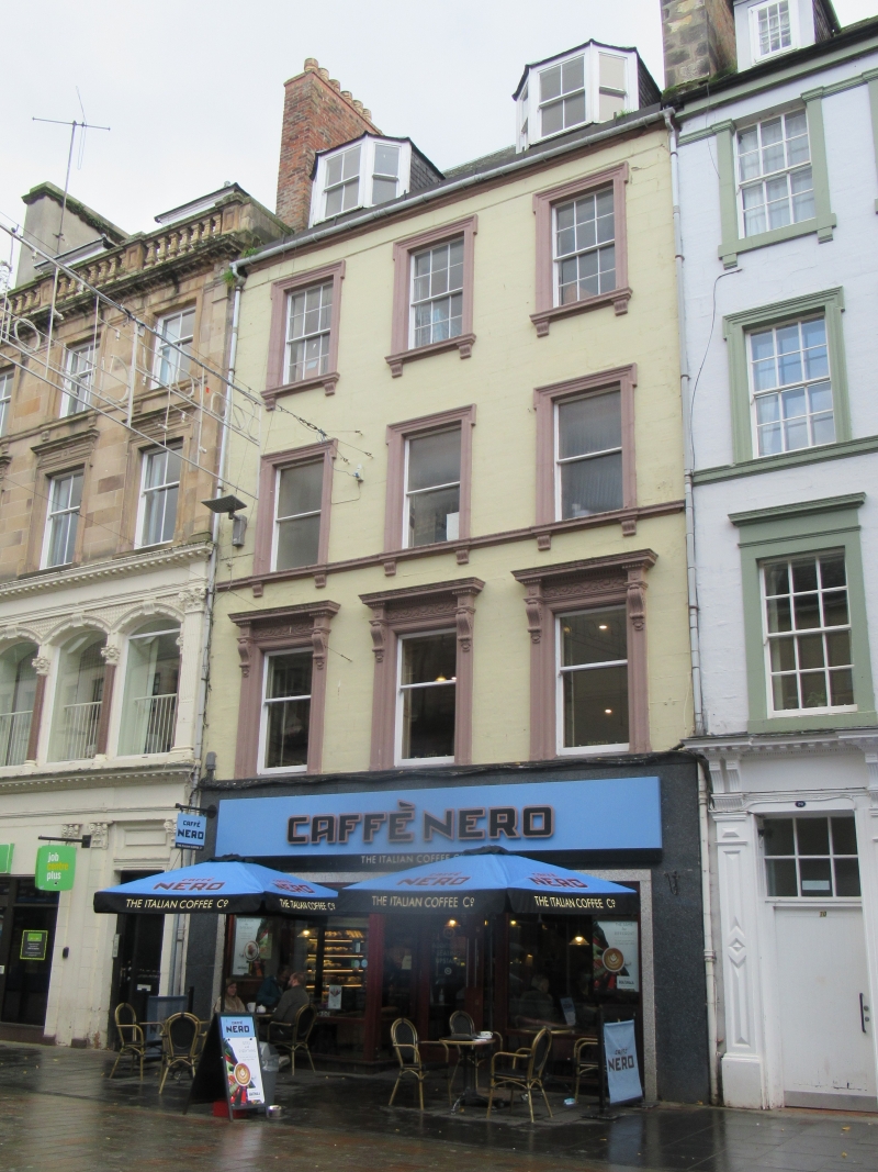
Entry Name: 64, 66, 68 High Street, Perth
Listing Name: High Street 64-68 (S Side) (Even Numbers)
Listing Date: 26 August 1977
Category: B
Source: Historic Scotland
Source ID: 385142
Historic Scotland Designation Reference: LB39475
Building Class: Cultural
ID on this website: 200385142
Location: Perth
County: Perth and Kinross
Town: Perth
Electoral Ward: Perth City Centre
Traditional County: Perthshire
Tagged with: Architectural structure
Earlier 19th century. 4-storey and attic, painted with ground
floor shop: 3-window with consoled cornices and decorative
friezes at 1st floor shouldered architraves, corbels under
cills at 2nd and 3rd floors. 2 canted dormers, slated roof.
External links are from the relevant listing authority and, where applicable, Wikidata. Wikidata IDs may be related buildings as well as this specific building. If you want to add or update a link, you will need to do so by editing the Wikidata entry.


Other nearby listed buildings
