Approximate Location Map
Large Map »
Latitude: 56.2127 / 56°12'45"N
Longitude: -2.7261 / 2°43'34"W
OS Eastings: 355058
OS Northings: 702473
OS Grid: NO550024
Mapcode National: GBR 2T.DKH7
Mapcode Global: WH7ST.333L
Plus Code: 9C8V677F+3G
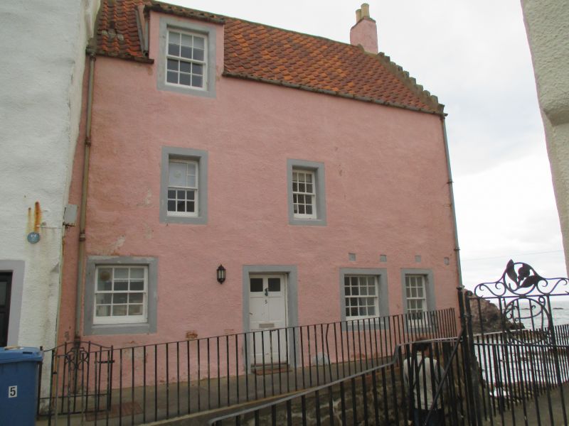
Entry Name: 4, 6 The Gyles, Pittenweem
Listing Name: 4-6 the Gyles
Listing Date: 18 August 1972
Category: A
Source: Historic Scotland
Source ID: 385841
Historic Scotland Designation Reference: LB39961
Building Class: Cultural
ID on this website: 200385841
Location: Pittenweem
County: Fife
Town: Pittenweem
Electoral Ward: East Neuk and Landward
Traditional County: Fife
Tagged with: Architectural structure
Dated 1597, rebuilt late 17th century. Large 3-storey and attic block, whitewashed harl with painted margins, semi-octagonal stair outshot, wallhead gable; slated, and crowstepped back wing with inset pediment dated 1597.
External links are from the relevant listing authority and, where applicable, Wikidata. Wikidata IDs may be related buildings as well as this specific building. If you want to add or update a link, you will need to do so by editing the Wikidata entry.


Other nearby listed buildings
