Approximate Location Map
Large Map »
Latitude: 56.212 / 56°12'43"N
Longitude: -2.7308 / 2°43'50"W
OS Eastings: 354768
OS Northings: 702402
OS Grid: NO547024
Mapcode National: GBR 2T.DQF8
Mapcode Global: WH7ST.04W3
Plus Code: 9C8V6769+RM
Entry Name: 2 Bruce's Wynd, Pittenweem
Listing Name: 30 and 31 Mid Shore and 1 and 2 Bruce's Wynd
Listing Date: 18 August 1972
Category: B
Source: Historic Scotland
Source ID: 385889
Historic Scotland Designation Reference: LB40006
Building Class: Cultural
ID on this website: 200385889
Location: Pittenweem
County: Fife
Town: Pittenweem
Electoral Ward: East Neuk and Landward
Traditional County: Fife
Tagged with: Architectural structure
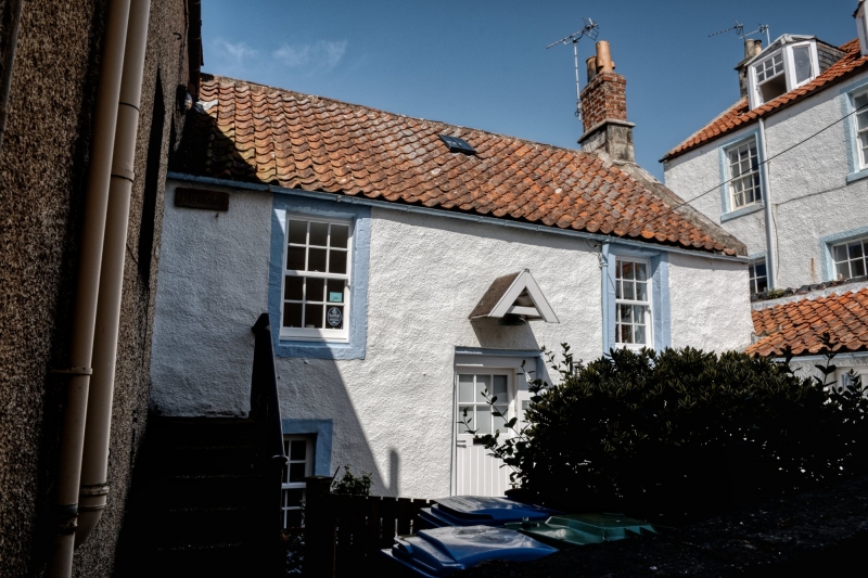
18th century. 2-storey and attic 3-window whitewashed harl and pantile with slate skirting, ashlar chimneyheads, canted dormer; back wing
(1 Bruce's Wynd) 2-storey 2-window harled with painted margins, pantiled; pantiled range of outhouses.
External links are from the relevant listing authority and, where applicable, Wikidata. Wikidata IDs may be related buildings as well as this specific building. If you want to add or update a link, you will need to do so by editing the Wikidata entry.


Other nearby listed buildings
