Approximate Location Map
Large Map »
Latitude: 56.3398 / 56°20'23"N
Longitude: -2.7925 / 2°47'33"W
OS Eastings: 351104
OS Northings: 716664
OS Grid: NO511166
Mapcode National: GBR 2R.4GLD
Mapcode Global: WH7S0.2XH6
Plus Code: 9C8V86Q4+WX
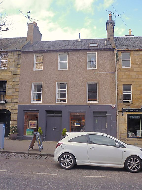
Entry Name: 47 South Street, St Andrews
Listing Name: 47 South Street.
Listing Date: 28 April 1959
Category: B
Source: Historic Scotland
Source ID: 386568
Historic Scotland Designation Reference: LB40616
Building Class: Cultural
ID on this website: 200386568
Location: St Andrews
County: Fife
Town: St Andrews
Electoral Ward: St Andrews
Traditional County: Fife
Tagged with: Architectural structure
Rebuilt 18th cent. to street. 3-storey, 3-window, painted
stucco, modern harl and slate, chamfered margins; vaulted
wing at back; ground floor shop.
External links are from the relevant listing authority and, where applicable, Wikidata. Wikidata IDs may be related buildings as well as this specific building. If you want to add or update a link, you will need to do so by editing the Wikidata entry.


Other nearby listed buildings
