Approximate Location Map
Large Map »
Latitude: 56.3397 / 56°20'22"N
Longitude: -2.7944 / 2°47'39"W
OS Eastings: 350986
OS Northings: 716655
OS Grid: NO509166
Mapcode National: GBR 2R.4G58
Mapcode Global: WH7S0.1XL8
Plus Code: 9C8V86Q4+V6
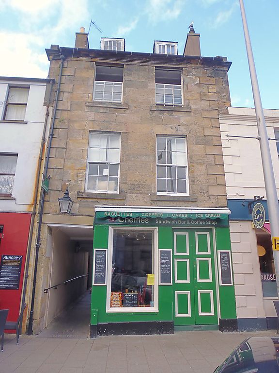
Entry Name: 91 South Street, St Andrews
Listing Name: 91 South Street and 1 Crail's Lane
Listing Date: 28 April 1959
Category: B
Source: Historic Scotland
Source ID: 386581
Historic Scotland Designation Reference: LB40628
Building Class: Cultural
ID on this website: 200386581
Location: St Andrews
County: Fife
Town: St Andrews
Electoral Ward: St Andrews
Traditional County: Fife
Tagged with: Architectural structure
Late 18th century, 3-storey and attic, 2-window, droved ashlar,
raised quoins, moulded eaves cornice, pend to lane; slated; 2 piended dormers; ground floor shop.
External links are from the relevant listing authority and, where applicable, Wikidata. Wikidata IDs may be related buildings as well as this specific building. If you want to add or update a link, you will need to do so by editing the Wikidata entry.


Other nearby listed buildings
