Approximate Location Map
Large Map »
Latitude: 56.3396 / 56°20'22"N
Longitude: -2.7905 / 2°47'25"W
OS Eastings: 351228
OS Northings: 716644
OS Grid: NO512166
Mapcode National: GBR 2R.4H0X
Mapcode Global: WH7S0.3XGB
Plus Code: 9C8V86Q5+VQ
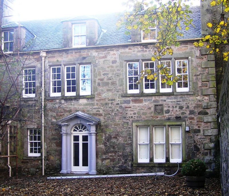
Entry Name: 14 South Street, St Andrews
Listing Name: 14 South Street Including Garden Walls
Listing Date: 23 February 1971
Category: B
Source: Historic Scotland
Source ID: 386625
Historic Scotland Designation Reference: LB40665
Building Class: Cultural
ID on this website: 200386625
Location: St Andrews
County: Fife
Town: St Andrews
Electoral Ward: St Andrews
Traditional County: Fife
Tagged with: House
Late 18th cent. 3-storey and attic, 3-window, rubble with
margins; slated; wing at back has doorpiece with pedimented
Gibbs surround and good rectangular fanlight; 2 swept
dormers.
External links are from the relevant listing authority and, where applicable, Wikidata. Wikidata IDs may be related buildings as well as this specific building. If you want to add or update a link, you will need to do so by editing the Wikidata entry.


Other nearby listed buildings
