Approximate Location Map
Large Map »
Latitude: 56.3394 / 56°20'21"N
Longitude: -2.7928 / 2°47'34"W
OS Eastings: 351086
OS Northings: 716615
OS Grid: NO510166
Mapcode National: GBR 2R.4GJC
Mapcode Global: WH7S0.2XCK
Plus Code: 9C8V86Q4+PV
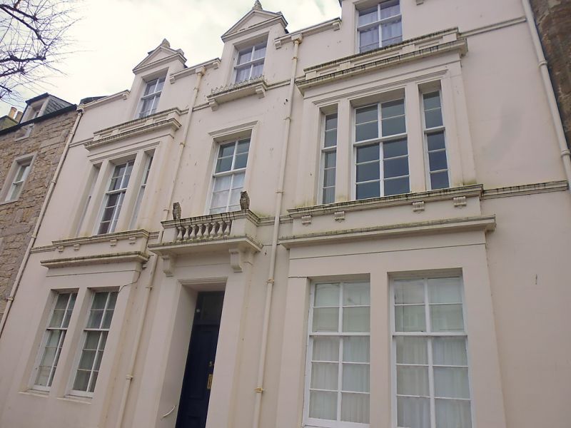
Entry Name: 54 South Street, St Andrews
Listing Name: 54 South Street, with Garden Walls of Lang Rig.
Listing Date: 28 April 1959
Category: B
Source: Historic Scotland
Source ID: 386642
Historic Scotland Designation Reference: LB40681
Building Class: Cultural
ID on this website: 200386642
Location: St Andrews
County: Fife
Town: St Andrews
Electoral Ward: St Andrews
Traditional County: Fife
Tagged with: Architectural structure
Rebuilt c.1860. 3-storey, late classic, 3-dormer heads of
17th cent. Scots type; ashlar and slate.
External links are from the relevant listing authority and, where applicable, Wikidata. Wikidata IDs may be related buildings as well as this specific building. If you want to add or update a link, you will need to do so by editing the Wikidata entry.


Other nearby listed buildings
