Approximate Location Map
Large Map »
Latitude: 56.339 / 56°20'20"N
Longitude: -2.7962 / 2°47'46"W
OS Eastings: 350873
OS Northings: 716574
OS Grid: NO508165
Mapcode National: GBR 2R.4MPZ
Mapcode Global: WH7S0.0XRV
Plus Code: 9C8V86Q3+HG
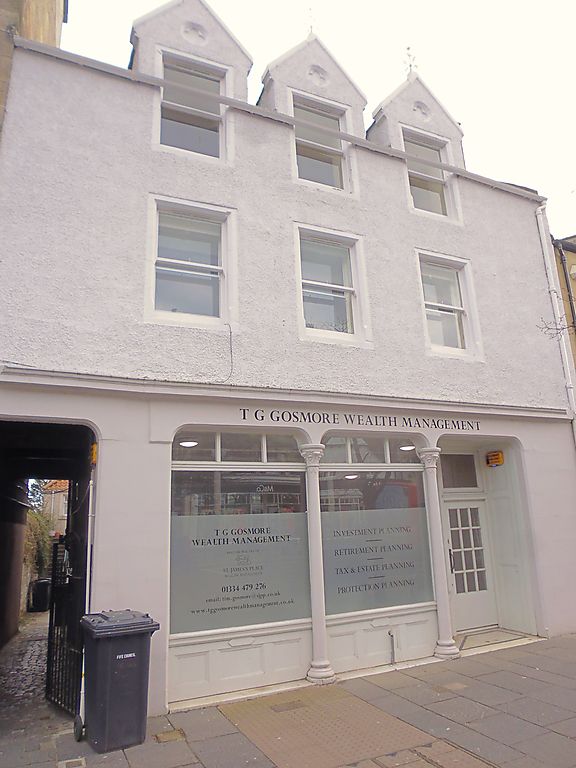
Entry Name: 102 South Street, St Andrews
Listing Name: 102-104 South Street
Listing Date: 8 June 1978
Category: B
Source: Historic Scotland
Source ID: 386661
Historic Scotland Designation Reference: LB40697
Building Class: Cultural
ID on this website: 200386661
Location: St Andrews
County: Fife
Town: St Andrews
Electoral Ward: St Andrews
Traditional County: Fife
Tagged with: Architectural structure
C.1870. 3-storey, 3-window, harled and slated; painted
margins. Gabled dormer heads; pend and original c.i. pillared
and flat-arched shop front.
External links are from the relevant listing authority and, where applicable, Wikidata. Wikidata IDs may be related buildings as well as this specific building. If you want to add or update a link, you will need to do so by editing the Wikidata entry.


Other nearby listed buildings
