Approximate Location Map
Large Map »
Latitude: 56.3389 / 56°20'20"N
Longitude: -2.7974 / 2°47'50"W
OS Eastings: 350801
OS Northings: 716570
OS Grid: NO508165
Mapcode National: GBR 2R.4MGB
Mapcode Global: WH7S0.0X5W
Plus Code: 9C8V86Q3+H2
Entry Name: Schoolhouse East, South Street, St Andrews
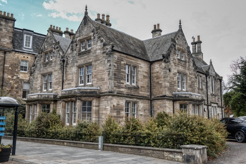
Listing Name: Madras College Schoolhouse East.
Listing Date: 28 April 1959
Category: B
Source: Historic Scotland
Source ID: 386669
Historic Scotland Designation Reference: LB40704
Building Class: Cultural
ID on this website: 200386669
Location: St Andrews
County: Fife
Town: St Andrews
Electoral Ward: St Andrews
Traditional County: Fife
Tagged with: House
1832, William Burn. 2-storey ashlar and slate with gabled attics, neo-Tudor with later addition.
External links are from the relevant listing authority and, where applicable, Wikidata. Wikidata IDs may be related buildings as well as this specific building. If you want to add or update a link, you will need to do so by editing the Wikidata entry.


Other nearby listed buildings
