Approximate Location Map
Large Map »
Latitude: 56.3387 / 56°20'19"N
Longitude: -2.7986 / 2°47'54"W
OS Eastings: 350728
OS Northings: 716545
OS Grid: NO507165
Mapcode National: GBR 2R.4M6Q
Mapcode Global: WH7RZ.ZYH2
Plus Code: 9C8V86Q2+FH
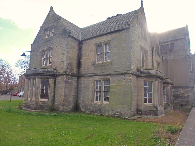
Entry Name: Schoolhouse West, South Street, St Andrews
Listing Name: Madras College Schoolhouse West
Listing Date: 28 April 1959
Category: B
Source: Historic Scotland
Source ID: 386670
Historic Scotland Designation Reference: LB40705
Building Class: Cultural
ID on this website: 200386670
Location: St Andrews
County: Fife
Town: St Andrews
Electoral Ward: St Andrews
Traditional County: Fife
Tagged with: House
1832, William Burn. 2-storey ashlar and slate neo-Tudor; symmetrical with above, but unaltered.
External links are from the relevant listing authority and, where applicable, Wikidata. Wikidata IDs may be related buildings as well as this specific building. If you want to add or update a link, you will need to do so by editing the Wikidata entry.


Other nearby listed buildings
