Approximate Location Map
Large Map »
Latitude: 56.3388 / 56°20'19"N
Longitude: -2.7989 / 2°47'56"W
OS Eastings: 350705
OS Northings: 716553
OS Grid: NO507165
Mapcode National: GBR 2R.4M3D
Mapcode Global: WH7RZ.ZYB0
Plus Code: 9C8V86Q2+GC
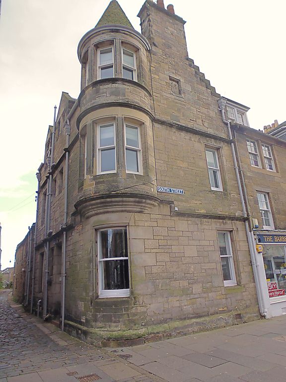
Entry Name: 132 South Street, St Andrews
Listing Name: 132 South Street and 1 Rose Lane
Listing Date: 23 February 1971
Category: C
Source: Historic Scotland
Source ID: 386678
Historic Scotland Designation Reference: LB40709
Building Class: Cultural
ID on this website: 200386678
Location: St Andrews
County: Fife
Town: St Andrews
Electoral Ward: St Andrews
Traditional County: Fife
Tagged with: Architectural structure
Dated 1904. 2-storey and attic, snecked rubble and slate; crowstepped gable; turret oriel at angle; inset wall panel JS MS 1904.
Re-categorised as C(S) from B for Group (2006). The listing relates specifically to the group interest of the subject. It applies, as always, to interior as well as exterior, as appropriate to building type.
External links are from the relevant listing authority and, where applicable, Wikidata. Wikidata IDs may be related buildings as well as this specific building. If you want to add or update a link, you will need to do so by editing the Wikidata entry.


Other nearby listed buildings
