Approximate Location Map
Large Map »
Latitude: 56.3386 / 56°20'18"N
Longitude: -2.8003 / 2°48'0"W
OS Eastings: 350624
OS Northings: 716535
OS Grid: NO506165
Mapcode National: GBR 2R.4LTD
Mapcode Global: WH7RZ.YYQ4
Plus Code: 9C8V85QX+CV
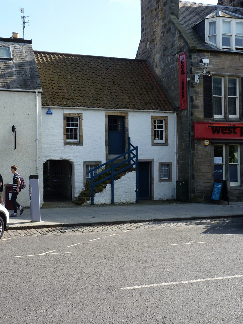
Entry Name: 168 South Street, St Andrews
Listing Name: 166, 168 South Street, Including Garden Walls of Lang Rig.
Listing Date: 23 February 1971
Category: B
Source: Historic Scotland
Source ID: 386698
Historic Scotland Designation Reference: LB40720
Building Class: Cultural
ID on this website: 200386698
Location: St Andrews
County: Fife
Town: St Andrews
Electoral Ward: St Andrews
Traditional County: Fife
Tagged with: Architectural structure
Early 18th cent. 2-storey, 2-window and centre door,
colour-washed harl with margins, forestair and pend.
External links are from the relevant listing authority and, where applicable, Wikidata. Wikidata IDs may be related buildings as well as this specific building. If you want to add or update a link, you will need to do so by editing the Wikidata entry.


Other nearby listed buildings
