Approximate Location Map
Large Map »
Latitude: 56.3386 / 56°20'18"N
Longitude: -2.8005 / 2°48'1"W
OS Eastings: 350606
OS Northings: 716535
OS Grid: NO506165
Mapcode National: GBR 2R.4LR6
Mapcode Global: WH7RZ.YYL4
Plus Code: 9C8V85QX+CQ
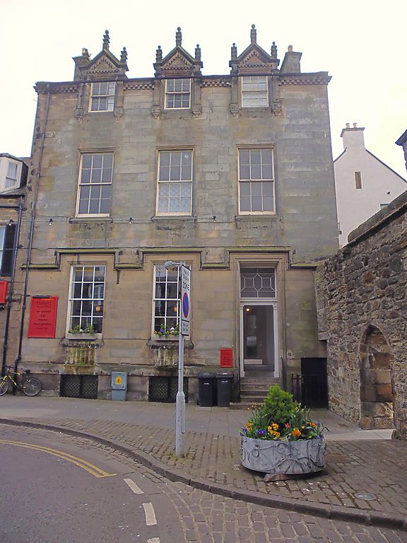
Entry Name: 172 South Street, St Andrews
Listing Name: 172 South Street.
Listing Date: 23 February 1971
Category: B
Source: Historic Scotland
Source ID: 386700
Historic Scotland Designation Reference: LB40722
Building Class: Cultural
ID on this website: 200386700
Location: St Andrews
County: Fife
Town: St Andrews
Electoral Ward: St Andrews
Traditional County: Fife
Tagged with: House
C.1850. Elizabethan. 3-storey and basement; 3-window; ashlar
and slate dormer heads at top floor with rich crocketted
pinnacles.
External links are from the relevant listing authority and, where applicable, Wikidata. Wikidata IDs may be related buildings as well as this specific building. If you want to add or update a link, you will need to do so by editing the Wikidata entry.


Other nearby listed buildings
