Approximate Location Map
Large Map »
Latitude: 56.3407 / 56°20'26"N
Longitude: -2.7888 / 2°47'19"W
OS Eastings: 351332
OS Northings: 716756
OS Grid: NO513167
Mapcode National: GBR 2R.4HDL
Mapcode Global: WH7S0.4W7K
Plus Code: 9C8V86R6+7F
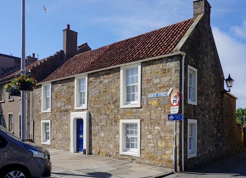
Entry Name: 1 North Street, St Andrews
Listing Name: 1 North Street
Listing Date: 28 April 1959
Category: B
Source: Historic Scotland
Source ID: 386737
Historic Scotland Designation Reference: LB40757
Building Class: Cultural
ID on this website: 200386737
Location: St Andrews
County: Fife
Town: St Andrews
Electoral Ward: St Andrews
Traditional County: Fife
Tagged with: Architectural structure
Late 18th century. 2-storey, 3-window rubble with margins; altered doorpiece, pantiled.
External links are from the relevant listing authority and, where applicable, Wikidata. Wikidata IDs may be related buildings as well as this specific building. If you want to add or update a link, you will need to do so by editing the Wikidata entry.


Other nearby listed buildings
