Approximate Location Map
Large Map »
Latitude: 56.3421 / 56°20'31"N
Longitude: -2.8002 / 2°48'0"W
OS Eastings: 350633
OS Northings: 716929
OS Grid: NO506169
Mapcode National: GBR 2R.4DVB
Mapcode Global: WH7RZ.YVRF
Plus Code: 9C8V85RX+VW
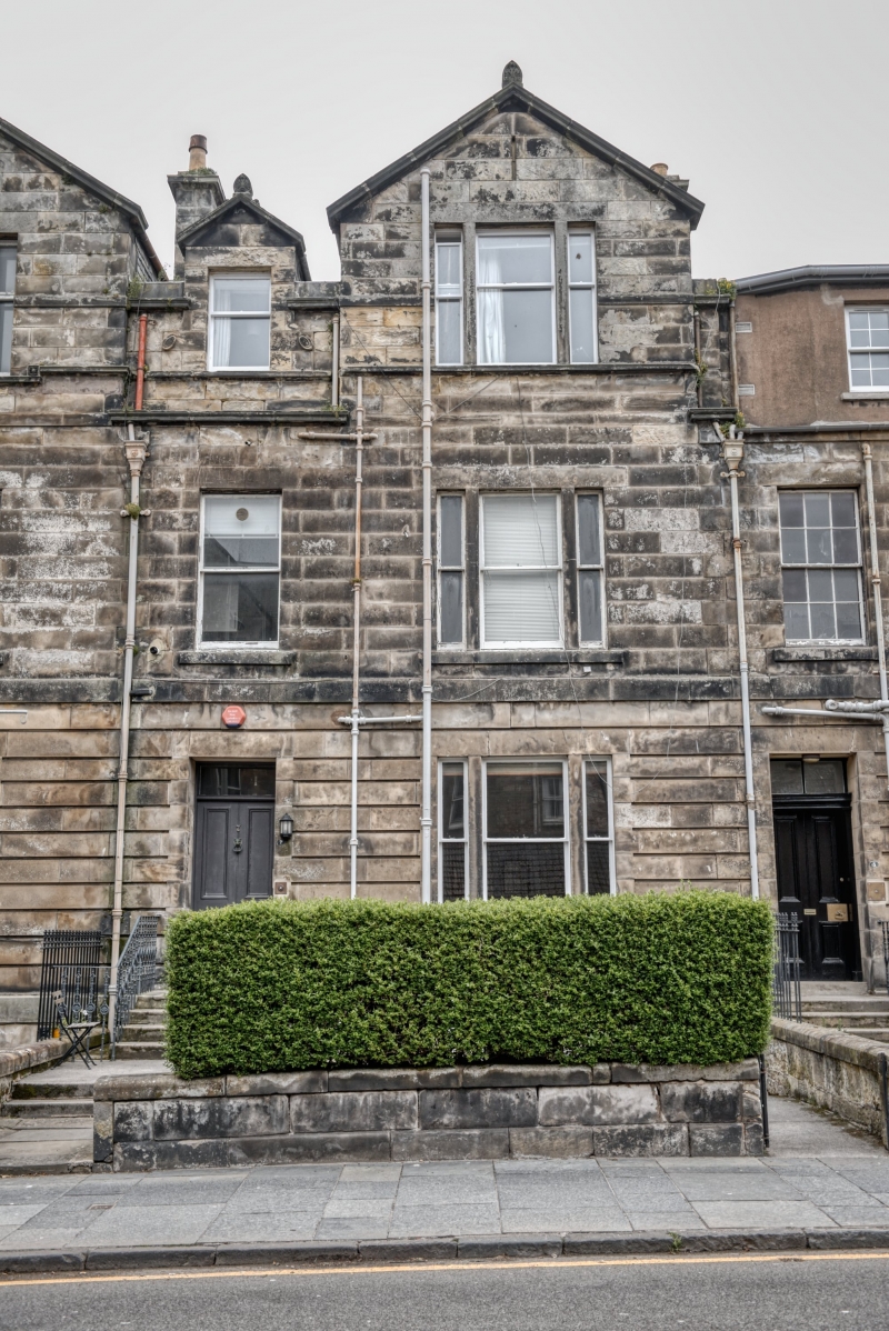
Entry Name: 7 Playfair Terrace, St Andrews
Listing Name: 1-8 Playfair Terrace.
Listing Date: 23 February 1971
Category: B
Source: Historic Scotland
Source ID: 386808
Historic Scotland Designation Reference: LB40806
Building Class: Cultural
ID on this website: 200386808
Location: St Andrews
County: Fife
Town: St Andrews
Electoral Ward: St Andrews
Traditional County: Fife
Tagged with: Terrace house
Begun 1846, George Rae, architect. Late neo-Greek. 2-storey
basement and attic, ashlar, channelled ground floor, twin
gable centre; palmette finials, slated. Nos. 6-8 altered, No.
1 with modern porch.
External links are from the relevant listing authority and, where applicable, Wikidata. Wikidata IDs may be related buildings as well as this specific building. If you want to add or update a link, you will need to do so by editing the Wikidata entry.


Other nearby listed buildings
