Approximate Location Map
Large Map »
Latitude: 56.3436 / 56°20'36"N
Longitude: -2.8011 / 2°48'4"W
OS Eastings: 350576
OS Northings: 717091
OS Grid: NO505170
Mapcode National: GBR 2R.46NB
Mapcode Global: WH7RZ.YT99
Plus Code: 9C8V85VX+CG
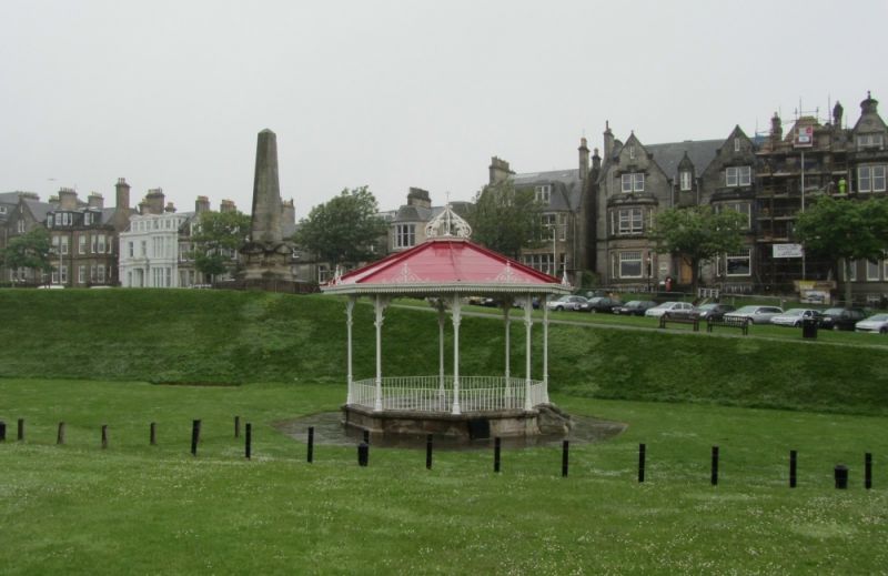
Entry Name: Bandstand, The Scores, St Andrews
Listing Name: Bandstand, the Scores.
Listing Date: 8 June 1978
Category: B
Source: Historic Scotland
Source ID: 386834
Historic Scotland Designation Reference: LB40818
Building Class: Cultural
ID on this website: 200386834
Location: St Andrews
County: Fife
Town: St Andrews
Electoral Ward: St Andrews
Traditional County: Fife
Tagged with: Bandstand
Circa 1890. Cast-iron octagon, delicately detailed; scroll-crown finial at roof.
External links are from the relevant listing authority and, where applicable, Wikidata. Wikidata IDs may be related buildings as well as this specific building. If you want to add or update a link, you will need to do so by editing the Wikidata entry.


Other nearby listed buildings
