Approximate Location Map
Large Map »
Latitude: 56.3432 / 56°20'35"N
Longitude: -2.807 / 2°48'25"W
OS Eastings: 350211
OS Northings: 717047
OS Grid: NO502170
Mapcode National: GBR 2Q.4C9J
Mapcode Global: WH7RZ.VTHM
Plus Code: 9C8V85VV+75
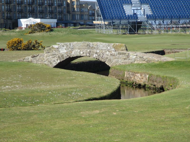
Entry Name: Golfer's Bridge, Swilken Burn, The Old Course, St Andrews
Listing Name: Golfers' Bridge Across the Swilken Burn.
Listing Date: 23 February 1971
Category: B
Source: Historic Scotland
Source ID: 386837
Historic Scotland Designation Reference: LB40821
Building Class: Cultural
Also known as: St Andrews, The Old Course, Swilken Burn, Golfer's Bridge
Swilken Bridge
ID on this website: 200386837
Location: St Andrews
County: Fife
Town: St Andrews
Electoral Ward: St Andrews
Traditional County: Fife
Tagged with: Bridge Footbridge Stone arch bridge
17th-18th century. Single segmental arch; rubble with low
parapets.
External links are from the relevant listing authority and, where applicable, Wikidata. Wikidata IDs may be related buildings as well as this specific building. If you want to add or update a link, you will need to do so by editing the Wikidata entry.


Other nearby listed buildings
