Approximate Location Map
Large Map »
Latitude: 56.3388 / 56°20'19"N
Longitude: -2.7953 / 2°47'42"W
OS Eastings: 350933
OS Northings: 716555
OS Grid: NO509165
Mapcode National: GBR 2R.4MXM
Mapcode Global: WH7S0.1X6Z
Plus Code: 9C8V86Q3+GV
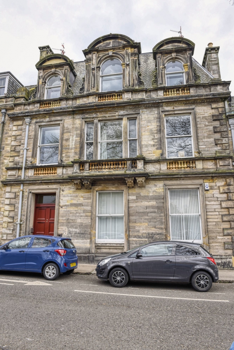
Entry Name: Council Offices, 2 Queen's Gardens, St Andrews
Listing Name: Burgh Offices, Queen's Gardens (Former Commercial Bank).
Listing Date: 23 February 1971
Category: B
Source: Historic Scotland
Source ID: 386857
Historic Scotland Designation Reference: LB40840
Building Class: Cultural
ID on this website: 200386857
Location: St Andrews
County: Fife
Town: St Andrews
Electoral Ward: St Andrews
Traditional County: Fife
Tagged with: Architectural structure
1869, David Rhind architect. Renaissance, 2-storey and attic;
stugged ashlar and slate; mansard roof and stone dormers.
External links are from the relevant listing authority and, where applicable, Wikidata. Wikidata IDs may be related buildings as well as this specific building. If you want to add or update a link, you will need to do so by editing the Wikidata entry.


Other nearby listed buildings
