Approximate Location Map
Large Map »
Latitude: 56.3396 / 56°20'22"N
Longitude: -2.7949 / 2°47'41"W
OS Eastings: 350956
OS Northings: 716644
OS Grid: NO509166
Mapcode National: GBR 2R.4G20
Mapcode Global: WH7S0.1XCC
Plus Code: 9C8V86Q4+R2
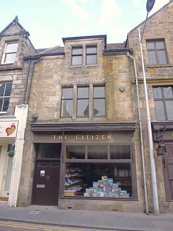
Entry Name: 29 Church Street, St Andrews
Listing Name: 29 Church Street.
Listing Date: 8 June 1978
Category: C
Source: Historic Scotland
Source ID: 386921
Historic Scotland Designation Reference: LB40881
Building Class: Cultural
ID on this website: 200386921
Location: St Andrews
County: Fife
Town: St Andrews
Electoral Ward: St Andrews
Traditional County: Fife
Tagged with: Architectural structure
.1890. 2-storey and attic, 1st window tripartite; modern
ground floor shop.
Re-categorised as C(S) from B for Group (2006). The listing relates specifically to the group interest of the subject. It applies, as always, to interior as well as exterior, as appropriate to building type.
External links are from the relevant listing authority and, where applicable, Wikidata. Wikidata IDs may be related buildings as well as this specific building. If you want to add or update a link, you will need to do so by editing the Wikidata entry.


Other nearby listed buildings
