Approximate Location Map
Large Map »
Latitude: 56.2051 / 56°12'18"N
Longitude: -2.7615 / 2°45'41"W
OS Eastings: 352853
OS Northings: 701645
OS Grid: NO528016
Mapcode National: GBR 2S.F3JP
Mapcode Global: WH7SS.K96G
Plus Code: 9C8V664Q+29
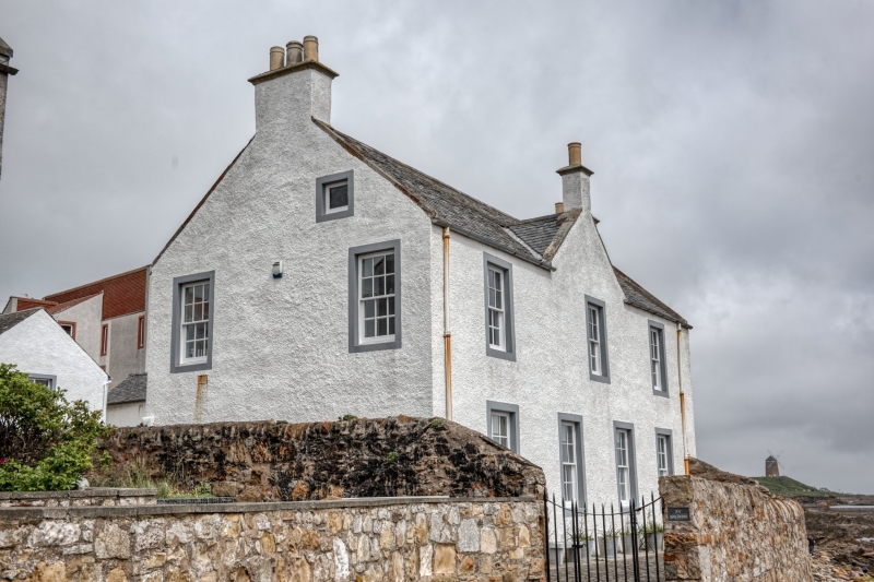
Entry Name: 15 East Shore, St Monance
Listing Name: 15 East Shore
Listing Date: 18 August 1972
Category: B
Source: Historic Scotland
Source ID: 387095
Historic Scotland Designation Reference: LB41003
Building Class: Cultural
ID on this website: 200387095
Location: St Monance
County: Fife
Town: St Monance
Electoral Ward: East Neuk and Landward
Traditional County: Fife
Tagged with: Architectural structure
Early 19th century. 2-storey 3-window with wall-head gable; seaward front stuccoed, gables rubble, slated: used as store in 1971, poor repair.
External links are from the relevant listing authority and, where applicable, Wikidata. Wikidata IDs may be related buildings as well as this specific building. If you want to add or update a link, you will need to do so by editing the Wikidata entry.


Other nearby listed buildings
