Approximate Location Map
Large Map »
Latitude: 56.2053 / 56°12'18"N
Longitude: -2.764 / 2°45'50"W
OS Eastings: 352701
OS Northings: 701670
OS Grid: NO527016
Mapcode National: GBR 2S.F2YS
Mapcode Global: WH7SS.J919
Plus Code: 9C8V664P+4C
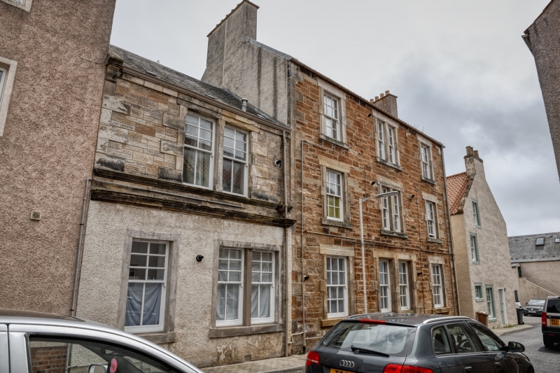
Entry Name: 42, 44, 46 East Street, St Monance
Listing Name: 42, 44 and 46 East Street
Listing Date: 18 August 1972
Category: C
Source: Historic Scotland
Source ID: 387129
Historic Scotland Designation Reference: LB41033
Building Class: Cultural
ID on this website: 200387129
Circa 1850. 3-storey 3-window (centre bipartite) snecked rubble with long and short dressings, pantiled.
Re-categorised as C(S) from B for Group (2006). The listing relates specifically to the group interest of the subject. It applies, as always, to interior as well as exterior, as appropriate to building type.
External links are from the relevant listing authority and, where applicable, Wikidata. Wikidata IDs may be related buildings as well as this specific building. If you want to add or update a link, you will need to do so by editing the Wikidata entry.


Other nearby listed buildings
