Approximate Location Map
Large Map »
Latitude: 56.1147 / 56°6'52"N
Longitude: -3.9364 / 3°56'11"W
OS Eastings: 279690
OS Northings: 693012
OS Grid: NS796930
Mapcode National: GBR 1C.LPML
Mapcode Global: WH4P6.HKQS
Plus Code: 9C8R4377+VC
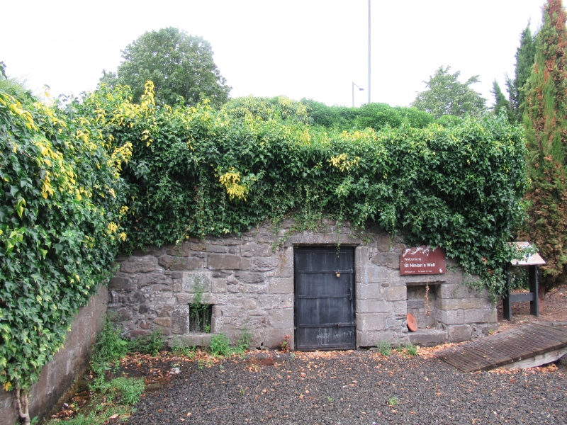
Entry Name: St Ninian's Well, Wellgreen Place, Stirling
Listing Name: St. Ninian's Well Wellgreen
Listing Date: 4 November 1965
Category: B
Source: Historic Scotland
Source ID: 387220
Historic Scotland Designation Reference: LB41124
Building Class: Cultural
ID on this website: 200387220
Location: Stirling
County: Stirling
Town: Stirling
Electoral Ward: Stirling East
Traditional County: Stirlingshire
Tagged with: Architectural structure
Robert Henderson, master mason 1737. Rectangular
single-storey 21' x 16' barrel-vaulted with washing-troughs: upper-storey now demolished and replaced by plain parapet.
External links are from the relevant listing authority and, where applicable, Wikidata. Wikidata IDs may be related buildings as well as this specific building. If you want to add or update a link, you will need to do so by editing the Wikidata entry.


Other nearby listed buildings
