Approximate Location Map
Large Map »
Latitude: 56.1277 / 56°7'39"N
Longitude: -3.9427 / 3°56'33"W
OS Eastings: 279338
OS Northings: 694477
OS Grid: NS793944
Mapcode National: GBR 1C.KVLX
Mapcode Global: WH4P6.D7QR
Plus Code: 9C8R43H4+3W
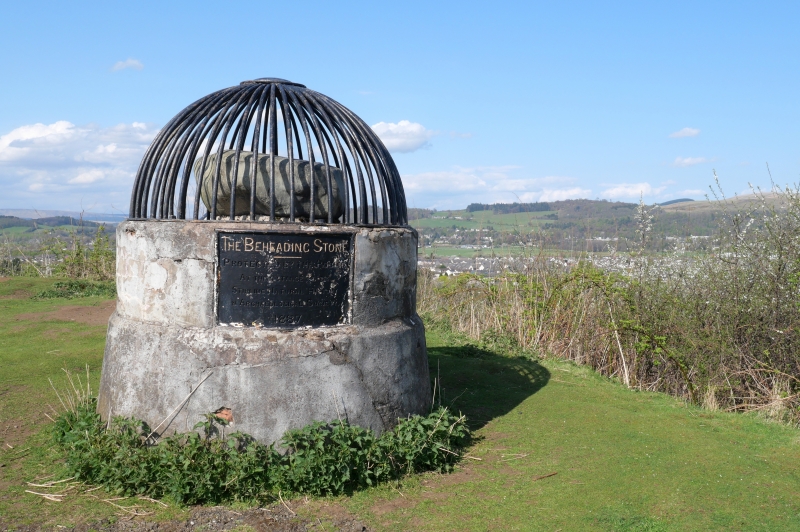
Entry Name: The Beheading Stone, Gowanhill, Stirling
Listing Name: Beheading Stone Gowanhill
Listing Date: 3 February 1978
Category: C
Source: Historic Scotland
Source ID: 387221
Historic Scotland Designation Reference: LB41125
Building Class: Cultural
ID on this website: 200387221
Location: Stirling
County: Stirling
Town: Stirling
Electoral Ward: Stirling North
Traditional County: Stirlingshire
Tagged with: Architectural structure
Stone surmounting circular concrete base and contained within
iron railings, forming pointed arch; plaque on base reads
1887.
External links are from the relevant listing authority and, where applicable, Wikidata. Wikidata IDs may be related buildings as well as this specific building. If you want to add or update a link, you will need to do so by editing the Wikidata entry.


Other nearby listed buildings
