Approximate Location Map
Large Map »
Latitude: 56.1246 / 56°7'28"N
Longitude: -3.9409 / 3°56'27"W
OS Eastings: 279442
OS Northings: 694130
OS Grid: NS794941
Mapcode National: GBR 1C.L2MB
Mapcode Global: WH4P6.FBL3
Plus Code: 9C8R43F5+VJ
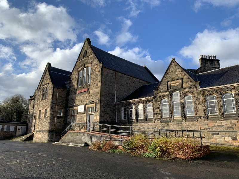
Entry Name: The Cowane Centre, Cowane Street, Stirling
Listing Name: Cowane Centre (Central Single Storey Section Only) Formerly Territorial Primary School, Cowane St
Listing Date: 3 February 1978
Category: C
Source: Historic Scotland
Source ID: 387228
Historic Scotland Designation Reference: LB41132
Building Class: Cultural
ID on this website: 200387228
Location: Stirling
County: Stirling
Town: Stirling
Electoral Ward: Stirling North
Traditional County: Stirlingshire
Tagged with: School building
Early/Mid Victorian. Single-storey T-plan rubble-built with
unusual rusticated detail; 11-window with segmental heads,
centre 3 stepped with hoodmould and gablet. Slated roof.
Additions 1884 etc of no great interest.
External links are from the relevant listing authority and, where applicable, Wikidata. Wikidata IDs may be related buildings as well as this specific building. If you want to add or update a link, you will need to do so by editing the Wikidata entry.


Other nearby listed buildings
