Approximate Location Map
Large Map »
Latitude: 56.1141 / 56°6'50"N
Longitude: -3.9247 / 3°55'29"W
OS Eastings: 280415
OS Northings: 692933
OS Grid: NS804929
Mapcode National: GBR 1D.LS92
Mapcode Global: WH4P6.PL86
Plus Code: 9C8R437G+M4
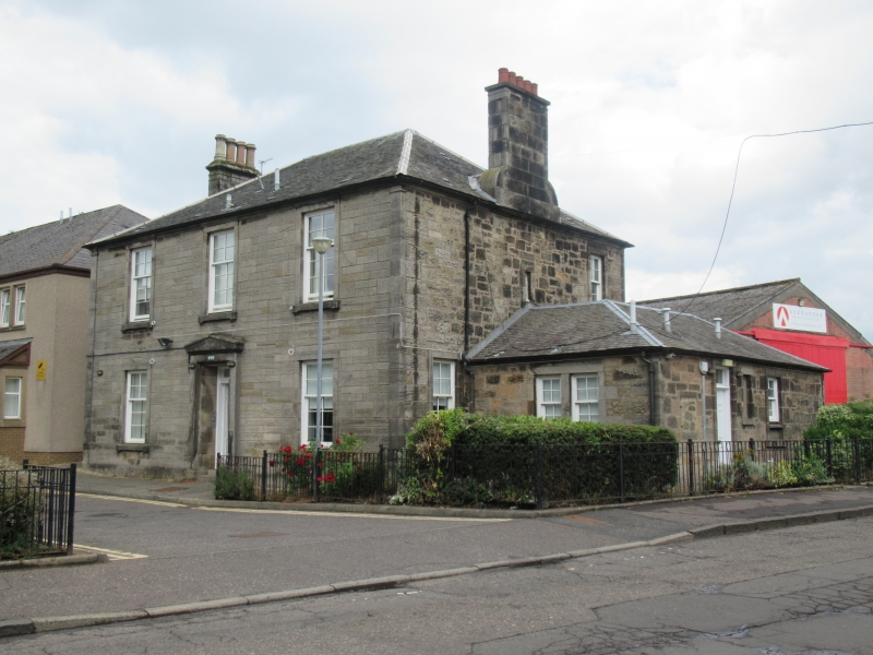
Entry Name: Springkerse House, Springkerse Road, Stirling
Listing Name: Springkerse Springkerse House
Listing Date: 3 February 1978
Category: C
Source: Historic Scotland
Source ID: 387247
Historic Scotland Designation Reference: LB41152
Building Class: Cultural
ID on this website: 200387247
Location: Stirling
County: Stirling
Town: Stirling
Electoral Ward: Stirling East
Traditional County: Stirlingshire
Tagged with: House
Circa 1840. Plain 2-storey 3-window rubble-built domestic
with pedimented doorpiece, shaped chimney gables on flanks,
slated, hipped roof. Single-storey side wing.
External links are from the relevant listing authority and, where applicable, Wikidata. Wikidata IDs may be related buildings as well as this specific building. If you want to add or update a link, you will need to do so by editing the Wikidata entry.


Other nearby listed buildings
