Approximate Location Map
Large Map »
Latitude: 56.1219 / 56°7'18"N
Longitude: -3.9352 / 3°56'6"W
OS Eastings: 279787
OS Northings: 693813
OS Grid: NS797938
Mapcode National: GBR 1C.L9WZ
Mapcode Global: WH4P6.JD97
Plus Code: 9C8R43C7+QW
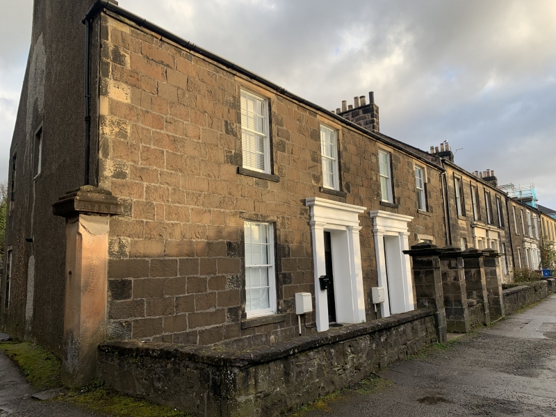
Entry Name: 13 Forth Place, Stirling
Listing Name: Forth Place 13, 15
Listing Date: 3 February 1978
Category: B
Source: Historic Scotland
Source ID: 387465
Historic Scotland Designation Reference: LB41289
Building Class: Cultural
ID on this website: 200387465
Location: Stirling
County: Stirling
Town: Stirling
Electoral Ward: Stirling North
Traditional County: Stirlingshire
Tagged with: House
Early 19th century, 2-storey 4-window rough whin ashlar with
twin Roman Doric pilastered doorpieces. Slated roof. Original
glazing. Square gatepiers.
Original glazing.
External links are from the relevant listing authority and, where applicable, Wikidata. Wikidata IDs may be related buildings as well as this specific building. If you want to add or update a link, you will need to do so by editing the Wikidata entry.


Other nearby listed buildings
