Approximate Location Map
Large Map »
Latitude: 56.1219 / 56°7'18"N
Longitude: -3.9407 / 3°56'26"W
OS Eastings: 279444
OS Northings: 693824
OS Grid: NS794938
Mapcode National: GBR 1C.L8N9
Mapcode Global: WH4P6.FDP7
Plus Code: 9C8R43C5+QP
Entry Name: 13-15 Irvine Place, Stirling
Listing Name: Irvine Place 13, 15
Listing Date: 4 November 1965
Category: B
Source: Historic Scotland
Source ID: 387511
Historic Scotland Designation Reference: LB41318
Building Class: Cultural
ID on this website: 200387511
Location: Stirling
County: Stirling
Town: Stirling
Electoral Ward: Stirling North
Traditional County: Stirlingshire
Tagged with: House
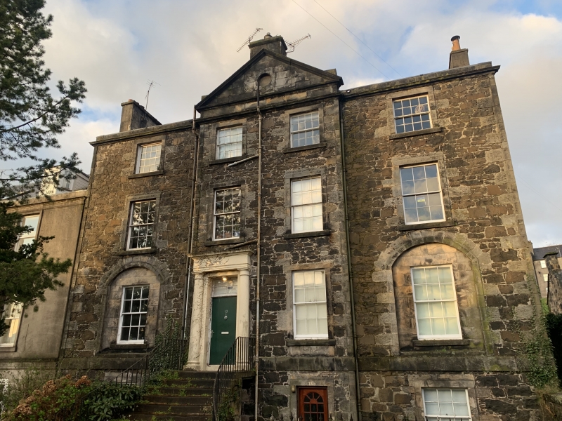
Early 19th century. 3-storey and basement, 4-window, whin
rubble, 2-window centre pediment; ground floor windows in
shallow arched recesses, asymmetrically placed Roman Doric
doorpiece, approached by widely splayed railed stair, slated
roof. Original glazing.
External links are from the relevant listing authority and, where applicable, Wikidata. Wikidata IDs may be related buildings as well as this specific building. If you want to add or update a link, you will need to do so by editing the Wikidata entry.


Other nearby listed buildings
