Approximate Location Map
Large Map »
Latitude: 56.1242 / 56°7'27"N
Longitude: -3.92 / 3°55'12"W
OS Eastings: 280739
OS Northings: 694048
OS Grid: NS807940
Mapcode National: GBR 1D.L19L
Mapcode Global: WH4P6.RBJF
Plus Code: 9C8R43FH+MX
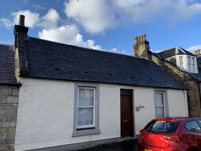
Entry Name: 18 South Street, Cambuskenneth
Listing Name: South Street 18 Cambuskenneth
Listing Date: 3 February 1978
Category: C
Source: Historic Scotland
Source ID: 387747
Historic Scotland Designation Reference: LB41478
Building Class: Cultural
ID on this website: 200387747
Location: Stirling
County: Stirling
Town: Stirling
Electoral Ward: Stirling North
Traditional County: Perthshire
Tagged with: Architectural structure
Early 19th century. Single-storey harled and white-washed,
2-window and centre door, chamfered openings, slated roof.
External links are from the relevant listing authority and, where applicable, Wikidata. Wikidata IDs may be related buildings as well as this specific building. If you want to add or update a link, you will need to do so by editing the Wikidata entry.


Other nearby listed buildings
