Approximate Location Map
Large Map »
Latitude: 56.1221 / 56°7'19"N
Longitude: -3.9437 / 3°56'37"W
OS Eastings: 279259
OS Northings: 693852
OS Grid: NS792938
Mapcode National: GBR 1C.L7Z3
Mapcode Global: WH4P6.DD82
Plus Code: 9C8R43C4+RG
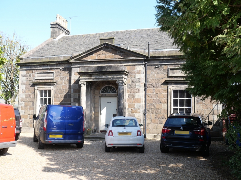
Entry Name: Mar Lodge, Upper Castlehill, Stirling
Listing Name: Upper Castlehill Mar Lodge, (Fronts Upper Castlehill) at Junction of Castle Wynd. Classified As Being on Mar Place Though It Has No Frontage to It.
Listing Date: 4 November 1965
Category: B
Source: Historic Scotland
Source ID: 387773
Historic Scotland Designation Reference: LB41502
Building Class: Cultural
ID on this website: 200387773
Location: Stirling
County: Stirling
Town: Stirling
Electoral Ward: Stirling North
Traditional County: Stirlingshire
Tagged with: House
Early 19th century. 3-storey and basement whin ashlar twin
bow windows on east front, entered on west at 2nd floor
level, pedimented centre bay with Ionic columned arched
fanlight doorpiece, 1-window either side; main cornice and
blocking course, slated roof.
External links are from the relevant listing authority and, where applicable, Wikidata. Wikidata IDs may be related buildings as well as this specific building. If you want to add or update a link, you will need to do so by editing the Wikidata entry.


Other nearby listed buildings
