Approximate Location Map
Large Map »
Latitude: 56.6232 / 56°37'23"N
Longitude: -6.0652 / 6°3'54"W
OS Eastings: 150728
OS Northings: 755318
OS Grid: NM507553
Mapcode National: GBR CCD6.QM9
Mapcode Global: WGZCZ.SSZG
Plus Code: 9C8MJWFM+7W
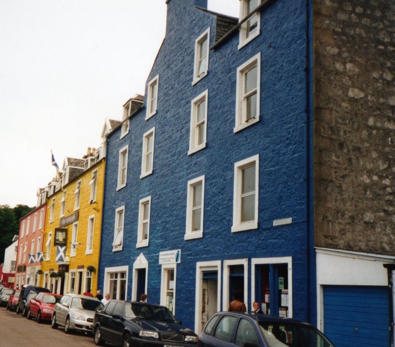
Entry Name: Royal Buildings, Main Street, Tobermory, Mull
Listing Name: Royal Buildings, Main Street
Listing Date: 20 July 1971
Category: C
Source: Historic Scotland
Source ID: 388510
Historic Scotland Designation Reference: LB42076
Building Class: Cultural
ID on this website: 200388510
Location: Tobermory
County: Argyll and Bute
Town: Tobermory
Electoral Ward: Oban South and the Isles
Traditional County: Argyllshire
Tagged with: Tenement
19th Century. 3 1/2 storeys. Rubble painted. Slated roof.
Piended dormers. Chimney gablet at front.
Re-categorised as C(S) from B for Group (2006). The listing relates specifically to the group interest of the subject. It applies, as always, to interior as well as exterior, as appropriate to building type.
External links are from the relevant listing authority and, where applicable, Wikidata. Wikidata IDs may be related buildings as well as this specific building. If you want to add or update a link, you will need to do so by editing the Wikidata entry.


Other nearby listed buildings
