Approximate Location Map
Large Map »
Latitude: 58.4439 / 58°26'37"N
Longitude: -3.0948 / 3°5'41"W
OS Eastings: 336188
OS Northings: 951137
OS Grid: ND361511
Mapcode National: GBR L6QD.WHR
Mapcode Global: WH6DN.F1J6
Plus Code: 9CCRCWV4+G3
Entry Name: Old St Fergus Church And Graveyard, High Street, Wick
Listing Name: High Street, Graveyard with Remains of Old St Fergus Church and Enclosing Walls
Listing Date: 15 August 1979
Category: B
Source: Historic Scotland
Source ID: 388827
Historic Scotland Designation Reference: LB42312
Building Class: Cultural
ID on this website: 200388827
Location: Wick
County: Highland
Town: Wick
Electoral Ward: Wick and East Caithness
Traditional County: Caithness
Tagged with: Cemetery Architectural structure
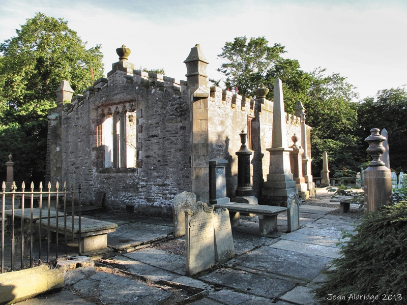
Rubble walls approximately 7? high with dressed stone cope. Sinclair aisle; remains of old St Fergus Church (circa 1680) with modern crenellation, the burial ground of the Sinclair of Ulster. Recumbent effigy; memorial slabs.
Corner site with St Fergus Lane. Interesting graves 17th, 18th and 19th centuries.
External links are from the relevant listing authority and, where applicable, Wikidata. Wikidata IDs may be related buildings as well as this specific building. If you want to add or update a link, you will need to do so by editing the Wikidata entry.


Other nearby listed buildings
