Approximate Location Map
Large Map »
Latitude: 56.0034 / 56°0'12"N
Longitude: -4.5818 / 4°34'54"W
OS Eastings: 239104
OS Northings: 681947
OS Grid: NS391819
Mapcode National: GBR 0L.TW2L
Mapcode Global: WH3NB.LCDK
Plus Code: 9C8Q2C39+97
Entry Name: Balloch Bridge, River Leven, Balloch Road, Balloch
Listing Name: Balloch, Balloch Road Bridge
Listing Date: 29 March 1996
Category: B
Source: Historic Scotland
Source ID: 389623
Historic Scotland Designation Reference: LB43215
Building Class: Cultural
ID on this website: 200389623
Location: Bonhill
County: West Dunbartonshire
Electoral Ward: Lomond
Parish: Bonhill
Traditional County: Dunbartonshire
Tagged with: Truss bridge Road bridge
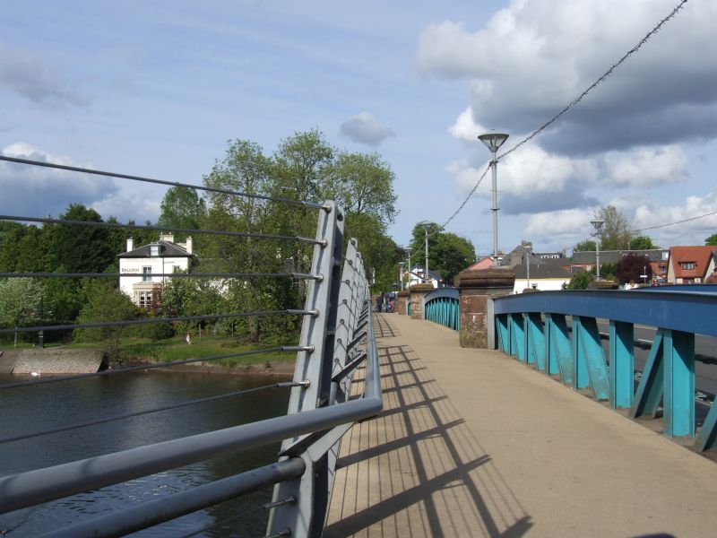
1908. Steel girder bridge carrrying road over River Leven. Parapet of 3 segmental arches, Double Warren truss, bolted steel coping. Ashlar dies. Flanking railings on steel plinth to outer left and right.
2 remaining lamp standards on piers. Tall piers, 3 flat arches.
The bridge replaces an earlier bridge.
External links are from the relevant listing authority and, where applicable, Wikidata. Wikidata IDs may be related buildings as well as this specific building. If you want to add or update a link, you will need to do so by editing the Wikidata entry.


Other nearby listed buildings
