Approximate Location Map
Large Map »
Latitude: 55.9728 / 55°58'22"N
Longitude: -2.9551 / 2°57'18"W
OS Eastings: 340487
OS Northings: 675947
OS Grid: NT404759
Mapcode National: GBR 2K.WN1S
Mapcode Global: WH7TV.L40H
Plus Code: 9C7VX2FV+4X
Entry Name: Harbour, Port Seton
Listing Name: Port Seton Harbour
Listing Date: 20 March 1997
Category: B
Source: Historic Scotland
Source ID: 390614
Historic Scotland Designation Reference: LB43956
Building Class: Cultural
ID on this website: 200390614
Location: Cockenzie and Portseton
County: East Lothian
Town: Cockenzie And Portseton
Electoral Ward: Preston, Seton and Gosford
Traditional County: East Lothian
Tagged with: Harbour
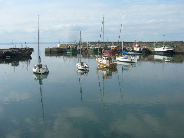
D & T Stevenson, engineers, 1880s. Concrete tidal harbour, covering approximately 8 acres. Inner harbour roughly in D-shape, N Pier
(730 ft) with hammerhead, S Pier along shore with Middle Pier projecting to enclose harbour. Outer breakwater to NW (450 ft) with short projecting feature to N at end. Protecting wall on N Pier only, up to 10 ft high with access steps. Middle pier paved with whinstone setts. Cast-iron capstans.
There was an earlier harbour on this site from 1679, which once functioned as the port for Prestonpans. This was totally destroyed by storm in 1810, leaving the fishermen in dire straits until the completion of Cockenzie Harbour (see separate listing) in 1835. The later introduction there of harbour dues for fishermen increased the pressure for the reconstruction of Port Seton?s haven. This was achieved in 1880 for nearly ?12,000, largely raised by subscription from the fishing community itself, with free land and a ?2,000 donation from Lord Wemyss. The Middle Pier was added soon after in 1885 for a further ?5,000. Before World War 1, Cockenzie and Port Seton had more than 650 fishermen and nearly 150 registered boats.
The harbour is listed category B as an early example of mass concrete construction. There is a range of stores, sheds and fish curers by the inner harbour which are not included in the listing.
External links are from the relevant listing authority and, where applicable, Wikidata. Wikidata IDs may be related buildings as well as this specific building. If you want to add or update a link, you will need to do so by editing the Wikidata entry.


Other nearby listed buildings
