Approximate Location Map
Large Map »
Latitude: 55.9327 / 55°55'57"N
Longitude: -3.9813 / 3°58'52"W
OS Eastings: 276317
OS Northings: 672842
OS Grid: NS763728
Mapcode National: GBR 19.ZCJP
Mapcode Global: WH4Q4.T49R
Plus Code: 9C7RW2M9+3F
Entry Name: Luggiebank Bridge
Listing Name: Luggiebank, Roadbridge over Luggie Water
Listing Date: 8 June 1995
Category: B
Source: Historic Scotland
Source ID: 394047
Historic Scotland Designation Reference: LB46705
Building Class: Cultural
Also known as: Luggie Bridge
ID on this website: 200394047
Location: Cumbernauld
County: North Lanarkshire
Town: Cumbernauld
Electoral Ward: Cumbernauld East
Traditional County: Dunbartonshire
Tagged with: Road bridge
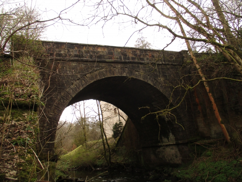
Thomas Telford, 1824. Single-span, round arch roadbridge over Luggie Water. Tooled and margined sandstone ashlar. Band course at springing point, V-chamfered voussoirs and intrados, parapet with band course and segmental coping, splayed buttresses.
The bridge no longer carries regular vehicular traffic, having been by-passed by modern road schemes.
External links are from the relevant listing authority and, where applicable, Wikidata. Wikidata IDs may be related buildings as well as this specific building. If you want to add or update a link, you will need to do so by editing the Wikidata entry.


Other nearby listed buildings
