Approximate Location Map
Large Map »
Latitude: 56.2452 / 56°14'42"N
Longitude: -4.8513 / 4°51'4"W
OS Eastings: 223417
OS Northings: 709514
OS Grid: NN234095
Mapcode National: GBR 08.BG3Y
Mapcode Global: WH2KX.G925
Plus Code: 9C8Q64WX+3F
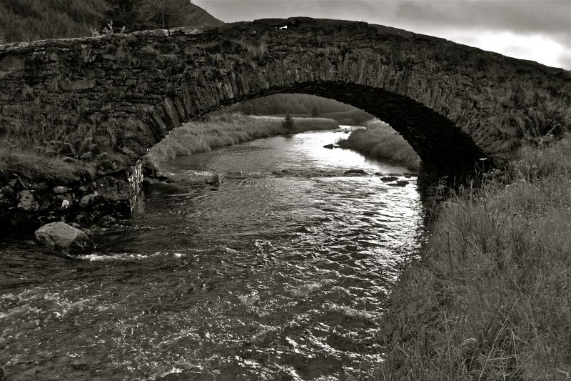
Entry Name: Kinglas Water, Butter Bridge
Listing Name: Butter Bridge, Kinglas Water
Listing Date: 20 July 1971
Category: B
Source: Historic Scotland
Source ID: 398789
Historic Scotland Designation Reference: LB50538
Building Class: Cultural
Also known as: Butter Bridge, Kinglas Water
Major Caulfeild's Bridge
ID on this website: 200398789
Location: Lochgoilhead and Kilmorich
County: Argyll and Bute
Electoral Ward: Lomond North
Parish: Lochgoilhead And Kilmorich
Traditional County: Argyllshire
Tagged with: Bridge Road bridge Stone arch bridge
C.1745? Segmental arch. Hump-backed. Random rubble. Slab coping.
On military road.
External links are from the relevant listing authority and, where applicable, Wikidata. Wikidata IDs may be related buildings as well as this specific building. If you want to add or update a link, you will need to do so by editing the Wikidata entry.


