Approximate Location Map
Large Map »
Latitude: 55.855 / 55°51'17"N
Longitude: -3.1616 / 3°9'41"W
OS Eastings: 327382
OS Northings: 663031
OS Grid: NT273630
Mapcode National: GBR 60CQ.BZ
Mapcode Global: WH6T6.D3QB
Plus Code: 9C7RVR3Q+X9
Entry Name: Roslin Cemetery, Roslin
Listing Name: Roslin Cemetery, including gates, gatepiers and boundary walls, excluding scheduled monument SM6458, Roslin
Listing Date: 7 March 1997
Last Amended: 19 July 2017
Category: C
Source: Historic Scotland
Source ID: 406787
Historic Scotland Designation Reference: LB44178
Building Class: Cultural
ID on this website: 200406787
Location: Lasswade
County: Midlothian
Electoral Ward: Midlothian West
Parish: Lasswade
Traditional County: Midlothian
Tagged with: Cemetery
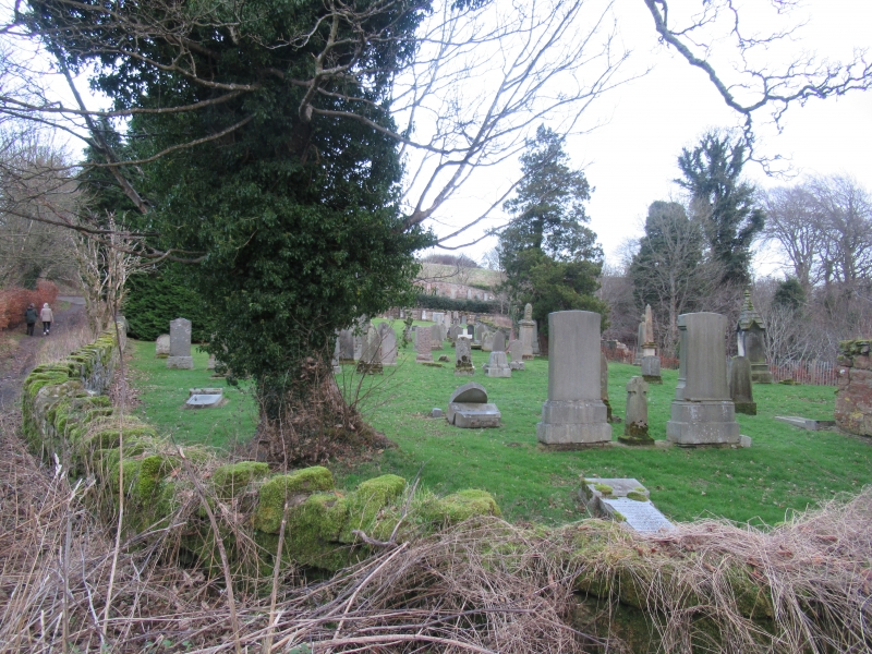
Late 19th- early 20th century with some headstones dating from the late 18th century. Two walled and gated graveyards on ground falling to SW and separated N-S by a track which leads to Rosslyn Castle.
UPPER GRAVEYARD: smaller; snecked, bull-faced sandstone boundary walls with stepped, castellated cope to N and shaped rubble cope to remainder. Square-plan banded bull-faced and ashlar gatepiers with polished ashlar cornice and obelisk cap. Decorative wrought-iron gates. Contains predominantly headstones from late 19th and 20th century.
LOWER GRAVEYARD: larger; snecked bull-faced sandstone boundary walls and shaped rubble cope. Square-plan bull-faced gatepiers with polished ashlar cornice and stet obelisk caps. Lower graveyard contains predominantly headstones, some wall-monuments, with several dating from the late 18th century (earliest,1782). Single storey 2-bay bull-faced sandstone, crowstepped gabled CARETAKER'S HUT to SW boundary wall: chamfered ashlar bipartite window to each bay. Grey slate roof; red clay stack to N gablehead; cast-iron rainwater goods.
It appears that the graveyard was originally a single site, located to the lower side of the track. It is in this section that the oldest headstones appear.
External links are from the relevant listing authority and, where applicable, Wikidata. Wikidata IDs may be related buildings as well as this specific building. If you want to add or update a link, you will need to do so by editing the Wikidata entry.


Other nearby listed buildings
