Approximate Location Map
Large Map »
Latitude: 51.7031 / 51°42'11"N
Longitude: -2.899 / 2°53'56"W
OS Eastings: 337968
OS Northings: 200864
OS Grid: SO379008
Mapcode National: GBR J9.3ZDC
Mapcode Global: VH79V.PGR8
Plus Code: 9C3VP432+69
Entry Name: 2 Four Ash Street, and attached iron railings
Listing Date: 1 April 1974
Last Amended: 30 April 2004
Grade: II
Source: Cadw
Source ID: 2146
Building Class: Domestic
ID on this website: 300002146
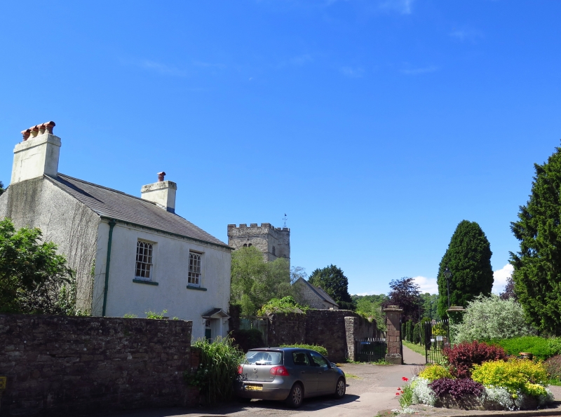
Location: Adjacent to the E entrance to the churchyard, on a corner site facing up the street.
County: Monmouthshire
Town: Usk
Community: Usk (Brynbuga)
Community: Usk
Built-Up Area: Usk
Traditional County: Monmouthshire
Tagged with: Building
Early C19. Originally owned by the church and used as parish office.
Detached cottage. Roughcast-rendered and painted; slate roof, with Gothick eaves cornice; narrow and long end stacks set across the ridge. Two storeys. Two-window range of sashes in reveals, 12/8 panes with Gothick intersecting glazing bars in the top sash. Ground floor doorway to right with bracketed gabled hood, fluted doorcase with recessed 6-panel door and transom light with polygonal glazing. Adjoining stone wall joins with front kerb which has iron railings with leaf and anthemion finials.
Listed as an early C19 house retaining character including Gothick glazing. Group value with other listed buildings in Four Ash Street, St Mary's church and churchyard wall and gates.
External links are from the relevant listing authority and, where applicable, Wikidata. Wikidata IDs may be related buildings as well as this specific building. If you want to add or update a link, you will need to do so by editing the Wikidata entry.


Other nearby listed buildings
