Approximate Location Map
Large Map »
Latitude: 51.9488 / 51°56'55"N
Longitude: -3.3913 / 3°23'28"W
OS Eastings: 304474
OS Northings: 228730
OS Grid: SO044287
Mapcode National: GBR YP.MFF6
Mapcode Global: VH6BZ.58JV
Plus Code: 9C3RWJX5+GF
Entry Name: 4 The Struet
Listing Date: 16 December 1976
Last Amended: 4 November 2005
Grade: II
Source: Cadw
Source ID: 7037
Building Class: Commercial
ID on this website: 300007037
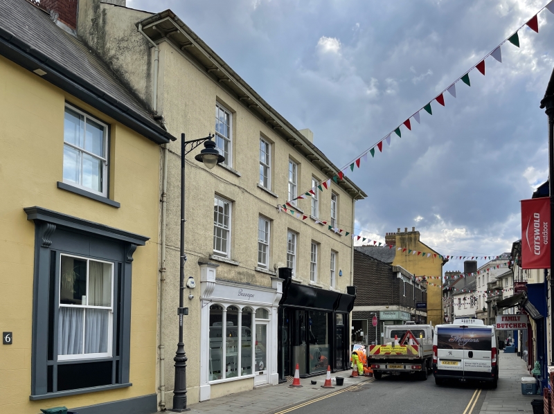
Location: On corner with George Street.
County: Powys
Town: Brecon
Community: Brecon (Aberhonddu)
Community: Brecon
Built-Up Area: Brecon
Traditional County: Brecknockshire
Tagged with: Building
Early-to-mid C19. Windows reinstated in late C20.
No 4 has late Victorian/Edwardian shopfront; deep fascia board between flanking pilasters with fancy capitals; windows come down almost to ground level; doorway set back to R between concave windows.
Early-to-Mid C19 building retaining much character, and with Group Value with adjacent buildings in The Struet and George Street.
External links are from the relevant listing authority and, where applicable, Wikidata. Wikidata IDs may be related buildings as well as this specific building. If you want to add or update a link, you will need to do so by editing the Wikidata entry.


Other nearby listed buildings
