Approximate Location Map
Large Map »
Latitude: 51.9507 / 51°57'2"N
Longitude: -3.3903 / 3°23'24"W
OS Eastings: 304548
OS Northings: 228931
OS Grid: SO045289
Mapcode National: GBR YP.M7P9
Mapcode Global: VH6BZ.671G
Plus Code: 9C3RXJ25+7V
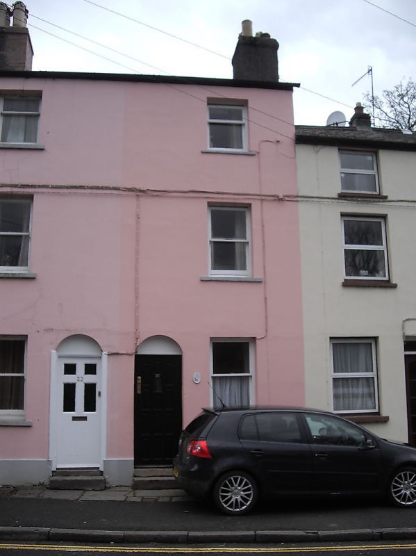
Entry Name: 31 The Struet
Listing Date: 16 December 1976
Last Amended: 4 November 2005
Grade: II
Source: Cadw
Source ID: 7053
Building Class: Domestic
ID on this website: 300007053
Location: Opposite Bishop Williamson Garden.
County: Powys
Town: Brecon
Community: Brecon (Aberhonddu)
Community: Brecon
Built-Up Area: Brecon
Traditional County: Brecknockshire
Tagged with: Building
Early to mid C19.
Nos.31 and 32 each with sash windows without glazing bars on all floors. Plain round-headed doorways towards centre with blocked tympana and modern door to No.31; six-panelled door, part glazed to No.32 whose doorway has remains of doorcase jambs.
Included for Group Value with adjacent listed properties in The Struet.
External links are from the relevant listing authority and, where applicable, Wikidata. Wikidata IDs may be related buildings as well as this specific building. If you want to add or update a link, you will need to do so by editing the Wikidata entry.


Other nearby listed buildings
