Approximate Location Map
Large Map »
Latitude: 51.9508 / 51°57'2"N
Longitude: -3.3901 / 3°23'24"W
OS Eastings: 304560
OS Northings: 228949
OS Grid: SO045289
Mapcode National: GBR YP.M7QC
Mapcode Global: VH6BZ.674B
Plus Code: 9C3RXJ25+8X
Entry Name: 37 The Struet
Listing Date: 16 December 1976
Last Amended: 4 November 2005
Grade: II
Source: Cadw
Source ID: 7055
Building Class: Domestic
ID on this website: 300007055
Location: Opposite footbridge over River Honddu.
County: Powys
Town: Brecon
Community: Brecon (Aberhonddu)
Community: Brecon
Built-Up Area: Brecon
Traditional County: Brecknockshire
Tagged with: Building
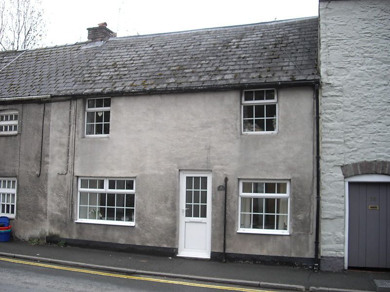
Early C19 row of six two-storey cottages, formerly each of one window bay and doorway, but end pairs now alalgamated making 4 properties.
Now one house, rendered, with two modern square-headed windows on first floor, on ground floor 2 larger modern windows, and off-centre modern door.
Row of early C19 small houses contributing to historic character of The Struet, which has group value with other listed buildings in the Street. No.37/38 included for group value with others in row.
External links are from the relevant listing authority and, where applicable, Wikidata. Wikidata IDs may be related buildings as well as this specific building. If you want to add or update a link, you will need to do so by editing the Wikidata entry.


Other nearby listed buildings
