Approximate Location Map
Large Map »
Latitude: 51.9456 / 51°56'44"N
Longitude: -3.387 / 3°23'13"W
OS Eastings: 304759
OS Northings: 228360
OS Grid: SO047283
Mapcode National: GBR YP.MNGC
Mapcode Global: VH6BZ.7CRC
Plus Code: 9C3RWJW7+65
Entry Name: NOS.23 & 24 the Watton, Powys
Listing Date: 16 December 1976
Last Amended: 4 November 2005
Grade: II
Source: Cadw
Source ID: 7107
Building Class: Domestic
ID on this website: 300007107
Location: Near junctions with Little Free Street and Rich Way.
County: Powys
Town: Brecon
Community: Brecon (Aberhonddu)
Community: Brecon
Built-Up Area: Brecon
Traditional County: Brecknockshire
Tagged with: Building
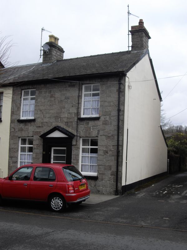
Early to mid C19 two-storey stone houses shown on 1834 plan of Brecon.
No.23 has exposed stone laid in regular courses; voussoirs to windows which are modern casements; modern door.
Pair of pre-1834 houses retaining character and with Group Value with adjacent listed buildings in the Watton.
External links are from the relevant listing authority and, where applicable, Wikidata. Wikidata IDs may be related buildings as well as this specific building. If you want to add or update a link, you will need to do so by editing the Wikidata entry.


Other nearby listed buildings
