Approximate Location Map
Large Map »
Latitude: 52.2403 / 52°14'25"N
Longitude: -3.1566 / 3°9'23"W
OS Eastings: 321117
OS Northings: 260868
OS Grid: SO211608
Mapcode National: GBR YZ.0ZL0
Mapcode Global: VH69K.7YKF
Plus Code: 9C4R6RRV+48
Entry Name: NO.9 Church Street, Powys
Listing Date: 29 April 1993
Last Amended: 31 August 1993
Grade: II
Source: Cadw
Source ID: 9370
Building Class: Domestic
ID on this website: 300009370
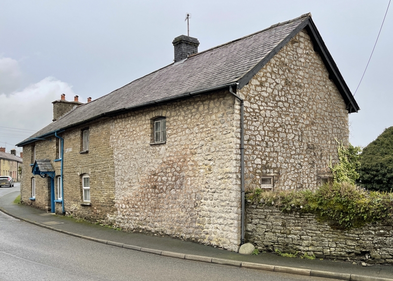
Location: A single building formerly known as The Kings Arms Inn.
County: Powys
Community: New Radnor (Maesyfed)
Community: New Radnor
Traditional County: Radnorshire
Tagged with: Building
C19 two storeys, coursed rubble, west end rebuilt in random rubble. Slate roof, brick ridge stack to right of centre, left end stack, rubble with three diagonally-set brick uppers with oversailing courses. Ground floor openings have cambered heads. Part-glazed front door under slated canopy with decorative pierced bargeboards. Modern windows.
Included for group value with other listed buildings in Church and High Streets.
External links are from the relevant listing authority and, where applicable, Wikidata. Wikidata IDs may be related buildings as well as this specific building. If you want to add or update a link, you will need to do so by editing the Wikidata entry.


Other nearby listed buildings
