Approximate Location Map
Large Map »
Latitude: 52.082 / 52°4'55"N
Longitude: -4.6626 / 4°39'45"W
OS Eastings: 217650
OS Northings: 245969
OS Grid: SN176459
Mapcode National: GBR CZ.BXTQ
Mapcode Global: VH2MP.4XDV
Plus Code: 9C4Q38JP+QX
Entry Name: NO.16 Quay Street, Dyfed
Listing Date: 14 April 1992
Last Amended: 14 April 1992
Grade: II
Source: Cadw
Source ID: 10514
Building Class: Domestic
ID on this website: 300010514
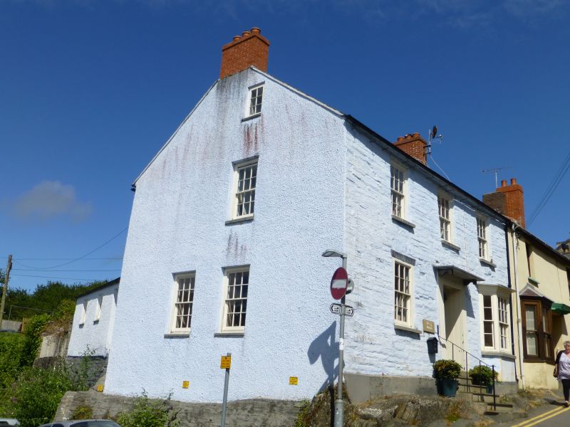
Location: Situated at west end of terraced row, on corner of Lower Mwldan.
County: Ceredigion
Community: Cardigan (Aberteifi)
Community: Cardigan
Built-Up Area: Cardigan
Traditional County: Cardiganshire
Tagged with: Building
Marked on Wood's 1834 map of Cardigan.
House, stucco with imitation slate roof and brick east end stack. Two storeys, 3-window range of 12-pane small sashes with slate sills. Centre first floor window is blank, ground floor right has early C19 canted bay of 4-12-4 pane sashes and cornice. Centre half-glazed door recessed in plan doorcase with shelf hood on brackets.
Group value.
External links are from the relevant listing authority and, where applicable, Wikidata. Wikidata IDs may be related buildings as well as this specific building. If you want to add or update a link, you will need to do so by editing the Wikidata entry.


Other nearby listed buildings
