Approximate Location Map
Large Map »
Latitude: 52.082 / 52°4'55"N
Longitude: -4.6625 / 4°39'45"W
OS Eastings: 217658
OS Northings: 245969
OS Grid: SN176459
Mapcode National: GBR CZ.BXW0
Mapcode Global: VH2MP.4XGV
Plus Code: 9C4Q38JP+QX
Entry Name: NO.17 Quay Street, Dyfed
Listing Date: 14 April 1992
Last Amended: 14 April 1992
Grade: II
Source: Cadw
Source ID: 10515
Building Class: Domestic
ID on this website: 300010515
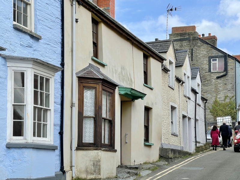
Location: Situated in terraced row towards west end of street.
County: Ceredigion
Community: Cardigan (Aberteifi)
Community: Cardigan
Built-Up Area: Cardigan
Traditional County: Cardiganshire
Tagged with: Building
Early C19. Marked on Wood's 1834 map of Cardigan.
House, stucco fronted with corrugated iron roof and brick end stacks. Two storeys, double fronted with 2 hornless 12-pane sashes above, later C19 canted bay to ground floor left, centre 6-panel door with timber doorcase of fluted pilasters and shelf hood on brackets, 4-pane sash to right. Painted slate sills.
Long rubble stone rear range with ridge stack and 2-storey front.
External links are from the relevant listing authority and, where applicable, Wikidata. Wikidata IDs may be related buildings as well as this specific building. If you want to add or update a link, you will need to do so by editing the Wikidata entry.


Other nearby listed buildings
