Approximate Location Map
Large Map »
Latitude: 51.4617 / 51°27'42"N
Longitude: -3.4478 / 3°26'52"W
OS Eastings: 299512
OS Northings: 174635
OS Grid: SS995746
Mapcode National: GBR HK.M5H2
Mapcode Global: VH6F8.6J38
Plus Code: 9C3RFH62+MV
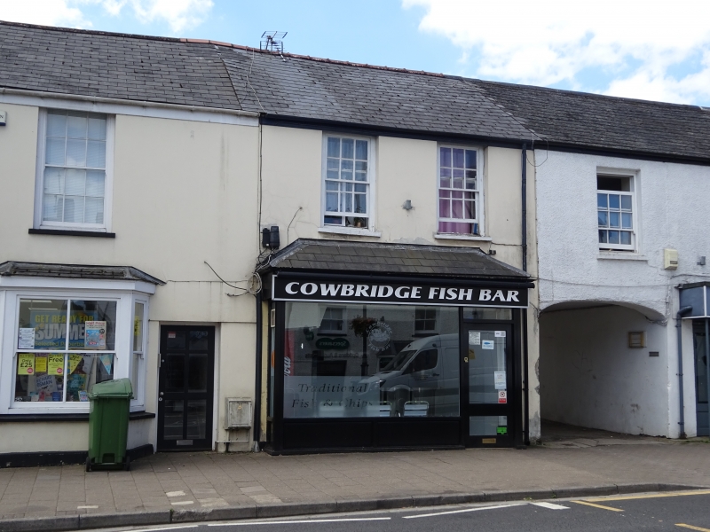
Entry Name: 22, High Street, Cowbridge, SOUTH GLAMORGAN
Listing Date: 3 February 1981
Last Amended: 16 September 1999
Grade: II
Source: Cadw
Source ID: 13218
Building Class: Commercial
ID on this website: 300013218
Location: Part of long 2-storey row between the higher Nos 16 and 30 High Street.
County: Vale of Glamorgan
Community: Cowbridge with Llanblethian (Y Bont-faen a Llanfleiddan)
Community: Cowbridge with Llanblethian
Locality: Cowbridge
Built-Up Area: Cowbridge
Traditional County: Glamorgan
Tagged with: Building
Probably early C19.
Two storeys. Slate roof with common roofline. Two window roughcast facade. C20 shop front on ground floor. Two 12-pane sash windows on first floor.
Included as part of a group of similar early C19 buildings in High Street.
External links are from the relevant listing authority and, where applicable, Wikidata. Wikidata IDs may be related buildings as well as this specific building. If you want to add or update a link, you will need to do so by editing the Wikidata entry.


Other nearby listed buildings
