History in Structure

Automobile Association Telephone Box

A Grade II Listed Building in Buan, Gwynedd

More Photos »
Approximate Location Map
Large Map »

Coordinates

Latitude: 52.9115 / 52°54'41"N

Longitude: -4.4934 / 4°29'36"W

OS Eastings: 232434

OS Northings: 337808

OS Grid: SH324378

Mapcode National: GBR 57.NLYT

Mapcode Global: WH44G.Y2GT

Plus Code: 9C4QWG64+JM

Entry Name: Automobile Association Telephone Box

Listing Date: 8 March 1994

Last Amended: 15 July 1998

Grade: II

Source: Cadw

Source ID: 14430

Building Class: Communications

ID on this website: 300014430

Location: Situated on NE side of the A497, some 100m NW of Boduan church.

County: Gwynedd

Town: Pwllheli

Community: Buan

Community: Buan

Locality: Boduan

Traditional County: Caernarfonshire

Tagged with: AA box

Find accommodation in
Nefyn

History

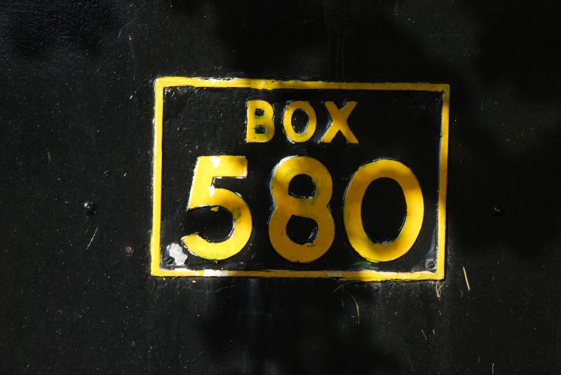
Automobile Association emergency service telephone box of the type that replaced pre-war boxes during the 1950s. There were some 1,000 in Great Britain of which 24 survive, less than 10 in Wales.

Exterior

Roadside telephone box in black-painted galvanised sheet metal over timber. Cross-gabled roof painted silver with centre capped vent. Yellow strips to main angles, door on SW front. Yellow painted 'Box 580' each side and more recent AA motif in side gables and on front sheet-metal door. Concrete plinth.

Interior

Altered interior. White painted internally with white perspex ceiling. Small floor-cupboard and c1990s wall-mounted phone.

Reasons for Listing

Grade II as a good example of a now relatively rare emergency service telephone box of the 1950s.

External Links

External links are from the relevant listing authority and, where applicable, Wikidata. Wikidata IDs may be related buildings as well as this specific building. If you want to add or update a link, you will need to do so by editing the Wikidata entry.

Recommended Books

Other nearby listed buildings

  • II Church of St Buan
    Situated on the NW side of the A497 road, some 5.5 km NW of Pwllheli, in churchyard with continuous stone banking wall and lych-gates to S and W.
  • II Out-buildings at Home Farm, Plas Boduan
    N part of Plas Boduan Home Farm out-buildings, located some 120m SW of Boduan Hall and some 200m NW of the A497 at Boduan.
  • II Plas Boduan
    Situated some 350m NE of the A 497 road and 350m NE of Boduan Church.
  • II Bryntirion
    Situated on the SW side of A497, some 500m NW of St Buan's Church, Boduan.
  • II Bryniau
    Situated down drive on W side of, and some 700m down, lane running SW from A497 opposite St Buan's Church.
  • II Lodge to N of Plas Boduan
    Situated E side of former drive now road running N from Boduan Hall, some 600m NW of the house.
  • II Glanrafon
    Situated on the S side of the B4354 road some 1.2 km E of junction with A497.
  • II Cefniwrch
    Situated down drive on E side of lane running S from A497, about 1.2 km S of Boduan church.

BritishListedBuildings.co.uk is an independent online resource and is not associated with any government department. All government data published here is used under licence. Please do not contact BritishListedBuildings.co.uk for any queries related to any individual listed building, planning permission related to listed buildings or the listing process itself.

British Listed Buildings is a Good Stuff website.