Approximate Location Map
Large Map »
Latitude: 51.9438 / 51°56'37"N
Longitude: -3.3838 / 3°23'1"W
OS Eastings: 304977
OS Northings: 228164
OS Grid: SO049281
Mapcode National: GBR YP.MP9H
Mapcode Global: VH6BZ.9DGP
Plus Code: 9C3RWJV8+GF
Entry Name: No 89, the Watton (SW Side), Powys
Listing Date: 16 December 1976
Last Amended: 4 November 2005
Grade: II
Source: Cadw
Source ID: 14902
Building Class: Domestic
ID on this website: 300014902
Location: Opposite The Barracks.
County: Powys
Town: Brecon
Community: Brecon (Aberhonddu)
Community: Brecon
Built-Up Area: Brecon
Traditional County: Brecknockshire
Tagged with: Building
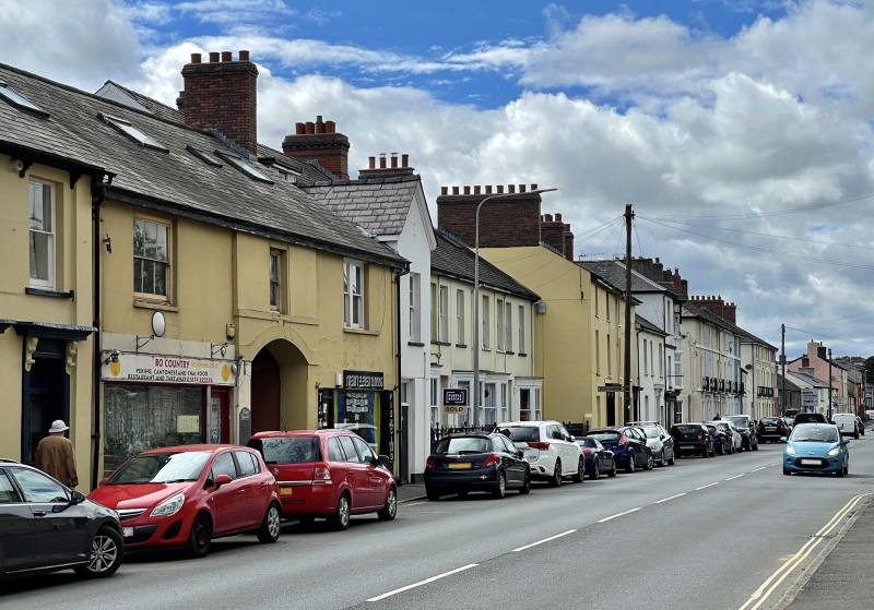
Early to mid C19.
Nos.88 & 89 are symmetrical. Central bay projects slightly forward; 4-pane sash window on first floor, narrow sill band and deep segmental headed arch to passage through ground floor. Left hand bay with large 6-pane sash window on first floor; on ground floor, modern shop front. Right hand bay with modern paired sashes on first floor and showroom below.
Early C19 block which has group value with adjacent buildings in The Watton.
External links are from the relevant listing authority and, where applicable, Wikidata. Wikidata IDs may be related buildings as well as this specific building. If you want to add or update a link, you will need to do so by editing the Wikidata entry.


Other nearby listed buildings
