Approximate Location Map
Large Map »
Latitude: 53.1838 / 53°11'1"N
Longitude: -3.0225 / 3°1'20"W
OS Eastings: 331767
OS Northings: 365676
OS Grid: SJ317656
Mapcode National: GBR 74.3J90
Mapcode Global: WH88C.J7YK
Plus Code: 9C5R5XMH+G2
Entry Name: No 60, Glynne Way (S Side), Clwyd
Listing Date: 16 November 1994
Last Amended: 16 November 1994
Grade: II
Source: Cadw
Source ID: 15055
Building Class: Domestic
ID on this website: 300015055
Location: On the street line.
County: Flintshire
Community: Hawarden (Penarlâg)
Community: Hawarden
Built-Up Area: Sandycroft
Traditional County: Flintshire
Tagged with: Building
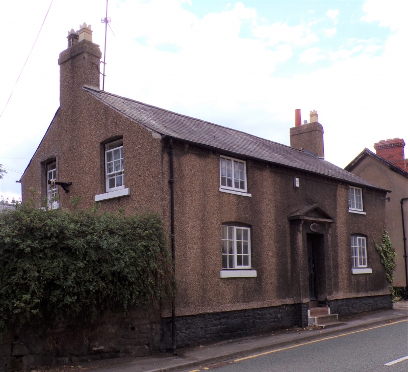
An early C19 2-storey stone house with brick detailing, now pebble-dashed. Shallow-pitched slate roof with plain end chimneys and dentilated eaves. Symetrical facade with central advanced
plain pedimented porch, with the pediment carried on simple brackets. Recessed entrance, via modern steps to plain modern door. Flanking 12-pane flush casement windows with projecting stone cills and cambered heads. Smaller 12-pane casements under eaves.
Included for group value with other listed items in Glynne Way.
External links are from the relevant listing authority and, where applicable, Wikidata. Wikidata IDs may be related buildings as well as this specific building. If you want to add or update a link, you will need to do so by editing the Wikidata entry.


Other nearby listed buildings
