Approximate Location Map
Large Map »
Latitude: 51.4787 / 51°28'43"N
Longitude: -3.1762 / 3°10'34"W
OS Eastings: 318416
OS Northings: 176186
OS Grid: ST184761
Mapcode National: GBR KJM.SW
Mapcode Global: VH6FD.W3R7
Plus Code: 9C3RFRHF+FG
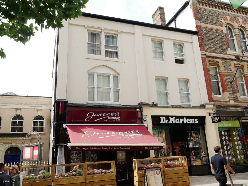
Entry Name: 36, The Hayes
Listing Date: 30 April 1999
Last Amended: 30 April 1999
Grade: II
Source: Cadw
Source ID: 21707
Building Class: Commercial
ID on this website: 300021707
Location: Between entrance block of Royal Arcade, and Tabernacl Chapel.
County: Cardiff
Community: Castle (Castell)
Community: Castle
Built-Up Area: Cardiff
Traditional County: Glamorgan
Tagged with: Building
Later C19 shop.
Three storey, 2-window shop; stucco front with pilaster bands, slate roof. Four-pane sash windows; restored C19 style shopfront.
Included for group value with adjacent listed buildings in the Hayes.
External links are from the relevant listing authority and, where applicable, Wikidata. Wikidata IDs may be related buildings as well as this specific building. If you want to add or update a link, you will need to do so by editing the Wikidata entry.


Other nearby listed buildings
